Tuesday, January 25, 2011

Mainly Rain for Tuesday into Wednesday

Low pressure is still set to track from near the Gulf coast today to near the Carolina coast tonight and tomorrow. This will spread mostly rain across North Carolina by this afternoon and this evening. Rain will continue into the night when a few thunderstorms are possible along the immediate coast.

Occasional rain showers are expected through Wednesday. The rain will change to a heavy wet snow for the North Carolina mountains by Wednesday morning. Areas east of the mountains stand very little chance to see accumulating snow. As the precipitation ends, the northwest Piedmont (northwest of Raleigh and the Triangle) may see a quick burst of snow. If the snow comes down heavy enough, a quick dusting on grassy surfaces is possible in the late afternoon from Greensboro to Roxboro to Oxford and Henderson. There is just a slight chance the Triangle may see a little snow mix in with the rain as the precipitation ends Wednesday afternoon and evening, but that chance appears very small right now.

The rain will be a welcome sight especially in central North Carolina where moderate drought conditions are building across the region. However, rain totals in the central parts of the state may not be as high as first thought yesterday...

It now appears the Triangle and Sandhills will see between 0.5" and 1" of rain while coastal locations could see between 1-2" with locally higher amounts.
Check in with Weather on the Ones on News 14 Carolina for updates on the forecast!
Lee Ringer
News 14 Carolina Meteorologist


Monday, January 24, 2011

Rain by Late Tuesday; What about Wednesday?

Low pressure tracking from near the Gulf coast to near the Carolina coast (or just inland from the Carolina coast) will bring mainly rain to our part of North Carolina for Tuesday into Wednesday. Ever since last week, there was a lot of uncertainty on whether or not this storm would produce snow. While this storm will produce mainly rain in our area, there is still the possibility for a change to some snow around the Triangle to the north and west before ending Wednesday afternoon or evening.

Look for rain to spread across the the Sandhills and coastal areas through Tuesday afternoon with the rain reaching the Triangle by late afternoon and evening. A few light showers are possible in eastern North Carolina mainly near the coast Monday night and early Tuesday morning associated with a coastal front, but the higher rain chance will come by late day Tuesday and Tuesday night.

Precipitation will continue through Tuesday night as all rain across the region. A few thunderstorms may develop right along the coast late Tuesday and Wednesday. Rain showers will continue into Wednesday. Locations south and east of Raleigh should see the precipitation end by late afternoon and evening as rain. From the Triangle to the north and west, it is possible the rain could change to snow for ending. A narrow band of heavy wet snow may fall for a couple to a few hours with the passage of an upper level low pressure system. The better chance for this may come just north and west of the Triangle. A slight change in the track in the upper level low could bring some accumulating snow over the Triangle late Wednesday or take it northwest of the Triangle. By tomorrow, we should have a better idea on what areas may see a change over to snow, but we may not be fully certain until the upper low is actually tracking over the Carolinas Wednesday. The best chance to see accumulating snow Wednesday in North Carolina will be in the higher elevations of the mountains.

Fortunately, this system will bring some much needed rain to our area. Much of central and eastern North Carolina should see between 1-2" of rain with some locally heavier amounts possible near the coast.

Stay tuned to News 14 Carolina for the latest updates on the forecast.


Lee Ringer
News 14 Carolina Meteorologist
www.facebook.com/LeeRingerNews14
www.twitter.com/LeeRingerNews14

Sunday, January 23, 2011

Is More Winter Weather on the Way? - Sunday AM Update

The Crystal Coast and parts of the Outer Banks were surprised with the amount of snow they received yesterday. Beaufort, Emerald Isle, and Havelock all reported 7" of snow! Locations along the southeast coast saw much less snow with only 0.1" reported in Wilmington.

Now our attention turns to the storm system expected to impact North Carolina Tuesday into Wednesday. While there is still uncertainty with this storm, it does appear precipitation will start as rain Tuesday for the Triangle and Sandhills and continue as rain into Tuesday night. By early Wednesday. the rain could change to snow for areas just north and west of the Triangle. The Triangle could be very close to the fine line between an area that will see all rain and the area that could change over to snow. Heavy snow is possible during this time period in the North Carolina mountains and foothills. Coastal areas can expect all rain for Tuesday into Wednesday.

Keep in mind the track and strength of low pressure that will move from the the Gulf Coast to near the Carolina coast will ultimately determine the type and amount of precipitation. A slight change in this track could easily create a big change in the forecast.

Just a cold rain is certainly a possibility for much of our area, but a change over to snow is also still a possibility in some locations. We should have better handle on the forecast by Monday. Stay tuned to News 14 Carolina for the latest in our Weather on the Ones updates.

Lee Ringer
News 14 Carolina Meteorologist
www.facebook.com/LeeRingerNews14
www.twitter.com/LeeRingerNews14

Saturday, January 22, 2011

Coastal Snow - Saturday

Just a quick update for Saturday evening... heavier snow than expected set up along the Crystal Coast and Outer Banks of North Carolina this afternoon. As of this posting just before 6pm, we had reports of as much as 7" of snow in Havelock and Emerald Isle and 5" in Morehead City. The snow will taper off along the Crystal Coast into the evening. For more on the latest weather conditions and forecast, check in with Weather on the Ones on News 14 Carolina.

Today's snow along the Crystal Coast just points out how difficult winter weather forecasting is in North Carolina. Low pressure has stayed right off the coast with the precipitation just grazing the coast. However that precipitation just grazing the coast has been enough to produce up to 7" of snow so far in some spots!

Lee Ringer
News 14 Carolina Meteorologist
www.facebook.com/LeeRingerNews14
www.twitter.com/LeeRingerNews14

Is More Winter Weather on the Way? - Saturday AM Update

Parts of the immediate North Carolina coastline should see some light snow today with the best chance coming during the afternoon and evening. As we have discussed here on the blog over the last couple of days, most of the precipitation with this low pressure should stay offshore. However, some precipitation may just graze the coast and that precipitation should fall as snow. Snowfall amounts should be relatively light with anywhere from a trace to 2" possible close to the immediate coast. I would expect the lighter end of that range along the Cape Fear coast (Brunswick, New Hanover, and Pender Counties) with perhaps the higher end of that range along coastal Onslow County, Carteret County, and the southern Outer Banks.

Then our attention turns to next week when several computer models have advertised a winter storm impacting parts of North Carolina from Tuesday into Wednesday. The exact track of this low pressure will determine what parts of the state will see snow and what parts will see rain. Coastal areas will more than likely see mainly rain out of this storm, but the Triangle and Sandhills could fall very close to the rain/snow line. It is still too early to say with any certainty if the Triangle and Sandhills would see mainly snow, mainly rain, or a mix of the two. This morning's hazardous weather outlook from Raleigh's National Weather Service Forecast Office has a good summary of what is possible during that time period:

THIS HAZARDOUS WEATHER OUTLOOK IS FOR CENTRAL NORTH CAROLINA.

.DAY ONE...TODAY AND TONIGHT.

HAZARDOUS WEATHER IS NOT EXPECTED AT THIS TIME.

.DAYS TWO THROUGH SEVEN.

..SUNDAY THROUGH FRIDAY.

A SIGNIFICANT WINTER STORM MAY AFFECT PORTIONS OF OUR REGION TUESDAY INTO WEDNESDAY. A STORM SYSTEM IS EXPECTED TO AFFECT OUR REGION EARLY NEXT WEEK. THE TRACK AND STRENGTH OF THE STORM WILL DETERMINE THE PREDOMINATE PRECIPITATION TYPE FOR OUR REGION. THE CURRENT FORECAST IS FOR A STORM TRACK FROM THE GULF OF MEXICO NORTHEAST ALONG THE CAROLINA COAST TUESDAY INTO WEDNESDAY. THIS WOULD BRING THE THREAT OF A SIGNIFICANT WINTER STORM TO WESTERN AND POSSIBLY CENTRAL NORTH CAROLINA... INCLUDING MUCH OF THE PIEDMONT.

IF THIS TRACK DEVIATES MORE INLAND... THEN LESS OF A WINTER STORM IMPACT CAN BE EXPECTED WITH MORE RAIN INTO THE PIEDMONT. DETAILS OF THE TRACK AND STRENGTH OF THE STORM CONTINUE TO VARY. IT WILL LIKELY BE MONDAY BEFORE THE FORECAST CAN BE FINE TUNED.

STAY TUNED THIS WEEKEND AND EARLY NEXT WEEK FOR DETAILS ON A POTENTIAL WINTER STORM TUESDAY INTO WEDNESDAY.

We'll keep you posted with the latest forecast with our Weather on the Ones updates on News 14 Carolina!

Lee Ringer
News 14 Carolina Meteorologist
www.facebook.com/LeeRingerNews14
www.twitter.com/LeeRingerNews14

Friday, January 21, 2011

Is More Winter Weather on the Way? - Friday AM Update

Computer models appear to be in better agreement this morning that low pressure will track up the Carolina coast during the early to middle part of next week bringing snow and rain to North Carolina. Some areas will see just rain, others will see all snow, and other may see a mix of snow to rain to snow.

Since we are still several days away, it is still much too early to make a call on what locations in the state could see significant snow and what areas would see just a cold rain. Based on the latest model data this morning, the Triangle would fall very close to the rain/snow line with significant snows possible to the west especially in the foothills and mountains. However, that all depends on the exact track of the low pressure. If the track changes more to the east, more significant snow would be possible toward the Triangle and even the Sandhills. At the same time, a more inland or westerly track would mean just rain for those areas. It appears the coast would mainly see just rain.

I caution that all of this is subject to change. Nailing down the exact track of low pressure that hasn't even developed yet is pretty much impossible at this point. We are still several days away and the models don't fully have a handle on how this storm system will evolve. Keep an eye on the forecast especially for Tuesday, Tuesday night, and Wednesday.

On another note, before we get to next week, low pressure will develop off the southeast coast Saturday. It should stay far enough offshore that any precipitation with that low will be out to sea. There is just a slight chance that the southern Outer Banks and Crystal Coast could see a few flurries or light snow showers Saturday evening.

Stay tuned to News 14 Carolina for the latest forecast!

Lee Ringer
News 14 Carolina Meteorologist
www.facebook.com/LeeRingerNews14
www.twitter.com/LeeRingerNews14

Thursday, January 20, 2011

Is More Winter Weather on the Way?

It has been quite the winter so far in the Carolinas, and we're only about half way through the season! After a brief warm up during the middle of this week, colder temperatures will return for the weekend, and the chance for winter precipitation could return by early next week.

Before we get to next week though, we'll have to keep an eye on low pressure that will develop off the southeast coast Saturday. This low should stay far enough offshore to keep most precipitation offshore. However, it is possible that the low tracks a little closer to the coast spreading snow flurries or light snow showers across coastal areas late Saturday afternoon or Saturday evening. The Triangle and Sandhills will stay dry with no precipitation over the weekend.

Then our attention turns to Monday into Tuesday of next week. Cold air will be in place over central North Carolina as low pressure tracks from near the Gulf coast to off the Carolina coast. Since this is still several days away, details with this system are still very uncertain and computer models are not in full agreement with exactly how this weather system will set up. It does appear precipitation will start by late Monday across the Sandhills and Triangle as some type of winter precipitation - either snow or a wintry mix. The precipitation may change to a cold rain into Tuesday in the Sandhills. The Triangle may be right on the dividing line between an area that sees mainly winter precipitation and an area that changes to a cold rain. At this time, it appears coastal areas would mainly just see rain showers. Precipitation amounts are uncertain at this point, so it's too early to say if this will just be a nuisance event or a more significant event.

As with the past winter systems this season, details in the forecast should become clearer over the coming days. Stay tuned for our Weather on the Ones updates for the latest!

Lee Ringer
News 14 Carolina Meteorologist
www.facebook.com/LeeRingerNews14
www.twitter.com/LeeRingerNews14

Wednesday, January 12, 2011

January 10-11, 2011 Snowfall

Snowfall totals from Monday-Tuesday, January 10-11, 2010:
  • Hampstead: 7.0"
  • Laurinburg: 7.0"
  • Rocky Point: 6.0"
  • Whiteville: 5.5"
  • Lumberton: 5.0"
  • Fayetteville: 5.0"
  • Raeford: 5.0"
  • Southern Pines: 5.0"
  • Elizabethtown: 5.0"
  • Burgaw: 4.0"
  • Kenansville: 4.0"
  • Havelock: 4.0"
  • Topsail Beach: 4.0"
  • Wilmington: 3.8"
  • Vander: 3.5"
  • Morehead City: 3.0"
  • Anderson Creek: 2.2"
  • Atlantic Beach: 1.5"
  • New Bern: 1.5"
  • Hillsborough: 1.1"
  • Louisburg: 1.0"
  • Mount Olive: 1.0"
  • Newton Grove: 1.0"
  • Roxboro: 1.0"
  • Sanford: 1.0"
  • Siler City: 1.0"
  • Wrightsville Beach: 1.0"
  • Creedmoor: 0.5"
  • Durham: 0.5"
  • Burlington: 0.5"
  • Chapel Hill: 0.2"
  • Raleigh: 0.2"
  • Wilson: Trace

Ice Accumulation from January 10-11, 2010:

  • Holly Springs: 0.2"
  • Laurinburg: 0.2"
  • Fayetteville: 0.2"
  • Raeford: 0.2"
  • Louisburg: 0.15"
  • Southern Pines: 0.15"
  • Oxford: 0.1"
  • Raleigh: 0.1"
  • Wilson: 0.1"
  • Goldsboro: 0.05"

Sunday, January 09, 2011

Tracking Winter Weather -- Sunday Morning Update


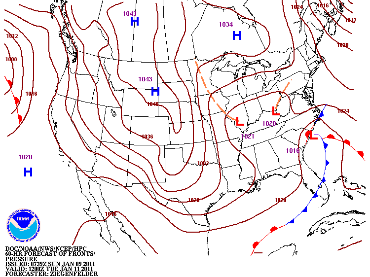
A storm system will track across the southeast into the new week spreading snow and ice across parts of the southeast including North Carolina. The details of the storm are becoming more clear for North Carolina, and it does not appear this will be a repeat of the post-Christmas snow. While some snow is possible with this storm, sleet and freezing rain could be the bigger issue for our region. Light snow is expected to spread into parts of the state near Charlotte and the NC/SC border around daybreak Monday. Because of dry air across much of central North Carolina, it will take a while for the precipitation to track north. Light snow will eventually spread from the southwest to northeast through Monday afternoon. By Monday evening, that precipitation will change to more of a wintry mix.

Based on the latest weather data, here's my thinking of what different regions of our coverage area can expect:

Triangle
Light snow will spread across the Triangle Monday afternoon or evening before changing to sleet then freezing rain or freezing drizzle Monday night. Precipitation will taper off Tuesday morning to around midday Tuesday. Around 1-2" of snow is possible before the change over to an icy mix. These accumulations will be slightly higher southwest of Raleigh and lower northeast of Raleigh. The snow accumulation will depend on the start time of the precipitation in the area. A later start time would mean less snow and an earlier start time would mean more snow accumulation. On top of any snow accumulation, 0.1" to 0.25" of ice accumulation is possible. This will create dangerous travel conditions Monday night and Tuesday morning. If ice accumulation reaches 0.25" or higher, look for power outages.

Sandhills
Light snow will spread across the Sandhills Monday morning and will then change to an icy mix by late Monday afternoon or evening. Snow accumulations of 1-4" is possible with the higher totals west of Fayetteville. Ice accumulation up to 0.25" is possible. Look for dangerous travel conditions developing Monday afternoon and continuing through Tuesday. If ice accumulation reaches 0.25" or higher, power outages will become a problem.

Wilson/Goldsboro
Some light snow is possible by late Monday afternoon or evening. Snow accumulation of a trace to an inch is possible. Any light snow will change to sleet and then freezing rain Monday evening and Monday night before ending Tuesday morning to around midday Tuesday. Ice accumulation of 0.1" to 0.25" is possible. Look for dangerous travel conditions Monday night and Tuesday morning.

Coastal viewing area
Light snow or a wintry mix will spread toward the southeast coast by late morning to early afternoon Monday. The precipitation will slowly build to the north through the afternoon and evening. A changeover to rain is expected by Monday evening. Most locations along the immediate coast will likely not see any accumulation as those locations will likely see mainly a cold rain. Areas inland from the coast across Columbus, Bladen, and Duplin County could see a dusting to 1" of snow/sleet accumulation with a light glazing of ice before changing to rain Monday night.

Keep in mind a change in track or intensity of this storm system could change the weather expected in your area. Winter weather forecasting is difficult in North Carolina, and changes in the forecast are still possible. Stay tuned to News 14 Carolina for the latest Weather on the Ones updates.

Lee Ringer
News 14 Carolina Meteorologist
www.twitter.com/LeeRingerNews14
www.facebook.com/LeeRingerNews14

Friday, January 07, 2011

Snow for Friday Night, More Snow and Ice for Early Next Week


Lots of winter weather to talk about today! I'll start with a disturbance that will produce a band of snow across central North Carolina tonight. This disturbance will create heavier accumulations in the mountains, but a band of a dusting to 2" is possible across the Piedmont to northeastern North Carolina. This includes areas around the Triangle.

Tonight's snow could begin as early as late afternoon. If that happens, the precipitation would start as light rain then mix with and change to snow. Accumulations would likely be mainly on grassy surfaces but some slush may build up on roads. Locations south of the Triangle near Fayetteville can look for mainly a light rain possibly mixed with some snow as the precipitation ends. Little to no accumulation is expected in the Fayetteville area. Most of the precipitation should taper off around midnight give or take an hour or two.

Temperatures will hover in the mid 30s as the precipitation falls and then fall below freezing as the precipitation ends. Lows in the upper 20s to near 30 are expected by daybreak Saturday morning in the Triangle and Sandhills. This could create issues with black ice Saturday morning even in areas that see mainly a light rain.

For our coastal viewers, tonight's band of precipitation will mainly miss our area to the north and northwest. A few light sprinkles cannot be ruled out late tonight.

This weekend our attention then turns to the potential for a more significant winter weather system for Monday through Tuesday of next week....


Low pressure along the Gulf coast Sunday night and Monday morning will track to off the North Carolina coast by Tuesday morning. Cold air will be in place across North Carolina as precipitation spreads across the state Monday afternoon. This looks to begin as snow in the Triangle and Sandhills, but I am growing more concerned that the snow will change to sleet and freezing rain Monday night or early Tuesday morning. If that happens, it appears there would be enough icing for significant travel problems and power outages. Keep in mind that is just one scenario with this system at this point.

The forecast remains even more uncertain for early next week in coastal North Carolina. Precipitation looks certain with some rain, but that rain may change to a wintry mix for a period of time.

Since we are still a few days away, a lot could still change with the forecast for next week. It is still too early to speculate on too many specifics about this storm. Through the weekend, we should have a better idea on how all of this will come together. Check in with Weather on the Ones on News 14 Carolina through the weekend for the latest.

Lee Ringer
News 14 Carolina Meteorologist
www.twitter.com/LeeRingerNews14
www.facebook.com/LeeRingerNews14

Thursday, January 06, 2011

A Winter Storm for Early Next Week?


We're watching the potential for a winter storm to impact the Carolinas early next week. Computer forecast models have been somewhat consistent showing low pressure tracking from near the Gulf coast to off the Carolina coast. The exact timing is still uncertain at this point, but from Monday into Tuesday appears to be the time period this storm system would affect our area. Cold air would be in place for much of our area at that time supporting the chance for wintry precipitation.

Since we are still several days away from early next week, I would caution that it is too early to forecast any details with this storm. Some models are forecasting accumulating snow across much of North Carolina with some indications of sleet and freezing rain causing problems in a narrow band across the state. Locations closer to the coast may see more of a cold rain. Again, this is all very preliminary at this point and the forecast will likely change some between now and next week.

Stay tuned to News 14 Carolina for updates through the rest of the week and the weekend.

Lee Ringer
News 14 Carolina Meteorologist
www.twitter.com/LeeRingerNews14
www.facebook.com/LeeRingerNews14

Monday, January 03, 2011

Cold January?

The first couple days of 2011 were much milder than most of December as temperatures reached the 60s in most of our area. Wilmington even hit 70 on New Years Day.


For most of this week, temperatures will return closer to normal for the first week of January, but even colder weather could be on the way by next week. Most long range indications show colder weather moving in for the upcoming weekend with colder than normal weather sticking around for much of next week. The 6 to 10 day temperature outlook shows colder than normal weather for much of the US --

The long range outlook for January now also calls for a colder than normal January for the Carolinas...

Will January be just as cold or colder than our very cold December? Only time will tell, but it does appear this winter will not be warmer than normal as previously forecast in the fall.

Lee Ringer
News 14 Carolina Meteorologist
www.twitter.com/LeeRingerNews14
www.facebook.com/LeeRingerNews14