
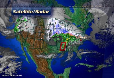
The above satellite and radar image from Saturday evening shows this big storm. On the north side of the storm, snow has impacted travel around Chicago and other parts of Illinois, Iowa, Wisconsin, and Minnesota. On the storm's southside, severe weather has been a big problem.
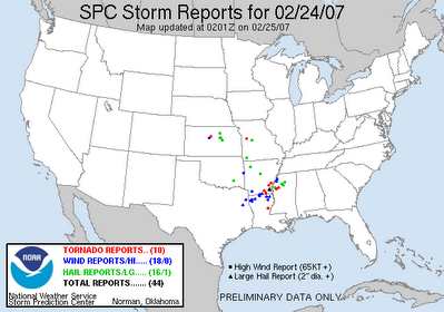
The above image from the Storm Prediction Center (www.spc.noaa.gov) shows Saturday's severe weather reports as of around 9pm. The red dots indicate tornadoes, the blue dots are reports of wind damage, and the green dots represent reports of large hail.
This storm system will continue to move to the east impacting our weather for Sunday. We can look for rain showers in our area by midday with the rain picking up in the afternoon. At that point, a few thunderstorms will be possible. A few of those could become strong.
 The Storm Prediction Center has outlined eastern North Carolina for the slight risk of severe thunderstorms. If storms develop in this area, they will have the potential to produce gusty winds, hail, and isolated tornadoes. Any severe weather Sunday is not expected to be as widespread as Saturday's severe weather across the lower Mississippi River Valley. However, we'll have to keep a close eye on Stormtracker Doppler radar through the afternoon. Stay with News 14 Carolina for Weather on the Ones updates every 10 minutes.
No comments:
Post a Comment