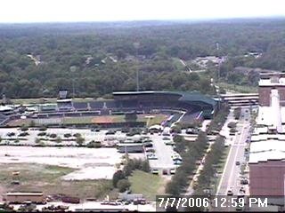
It is also a much brighter day today. If you are reading this from your cubicle at work with no window in sight, here's a view for comparison --

If you are thinking this is July and these comfortable summer conditions can't last forever, you are correct. We do expect nice weather through the weekend, but the heat and humidity will begin to increase by late in the weekend and early next week. Highs on Saturday in the News 14 Carolina viewing area should reach the mid 80s. We'll see the upper 80s Sunday, and we'll be back in the low 90s by Monday.
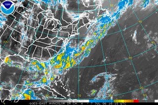
When making a forecast, a meteorologist always has to think -- is there anything that could happen that could make my forecast incorrect? Right now, it appears unlikely that something could change this weekend, but we will be watching the front that moved through the state on Thursday. That front would not move back toward North Carolina, but there have been occasions when a tropical system spins up along a frontal boundary across warm ocean waters. Here's a look at the satellite picture from midday Friday --

There are no signs of a tropical system developing along that front. However, at least one of the computer models I looked at while forecasting this morning hinted at a low developing along the front and spreading rain into North Carolina late in the weekend. Latest runs of that model this midday have backed off on that solution. Other models do not show the low developing. Because of that, we will stay with our forecast for pleasant weekend weather and just keep a close eye on that front for any changes. As you enjoy the nice weekend weather, check back with Weather on the Ones on News 14 Carolina in the event there are any changes to the current forecast. We always have our latest tropical outlook at :21 after the hour.

No comments:
Post a Comment