
 Thursday was a tragic day for fires in central North Carolina. Windy weather and dry conditions allowed fires to spread rapidly, and that certainly was the case as we watched over two dozen townhome units go up in flames in north Raleigh. You can read the latest on this and other fires around the area Thursday on our website at www.news14.com.
Thursday's fires were visible on radar and satellite imagery --
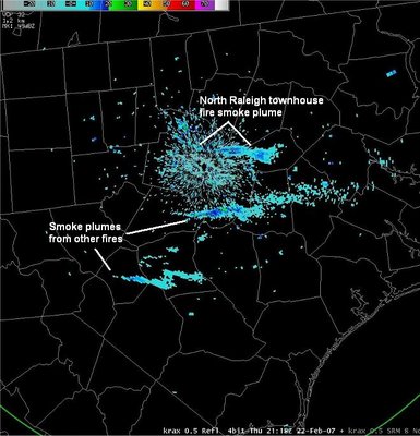 The National Weather Service's Doppler radar picked up on smoke plumes from the north Raleigh townhomes fire and the brush fire in Hoke County.
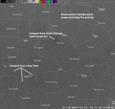 The above satellite image from Thursday afternoon also shows the fires. The darker pixels shows hotspots created by the fires.
Today isn't a much better day for fire weather. While a fire weather watch was cancelled this morning, all outdoor burning should be avoided today. Northwest winds at 10 to 20 mph along with low humidities could still allow any fire to spread rapidly.
Our breezy weather should diminish this Friday evening, and our attention in the Weather on the Ones Forecast Center will turn to a potent storm system developing over the nation's midsection.
The Storm Prediction Center (www.spc.noaa.gov) is watching an area from Kansas to Oklahoma to north Texas for the potential of a severe weather outbreak including tornadoes this afternoon.
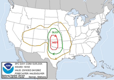
That same storm system could produce severe weather across parts of the southeast on Saturday. The SPC is watching an area from Arkansas to Louisiana to Mississippi for the greatest threat of severe weather on Saturday.
The storm will eventually spread rain toward North Carolina on Sunday. While we don't look for a severe weather outbreak in our area, thunderstorms will be possible in southeastern North Carolina. We'll keep an eye out for the possibility for a strong storm or two. Stay tuned to News 14 Carolina for Weather on the Ones updates through the weekend.
No comments:
Post a Comment