We are looking for quiet weather this weekend in central North Carolina, but we'll be watching a couple of weather systems from the Weather on the Ones Forecast Center.
The first is in the tropics --
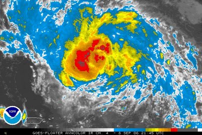
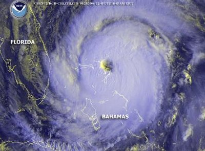
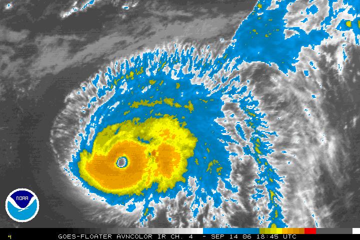
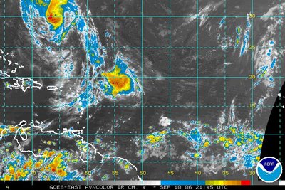
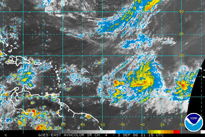
Tropical Storm Florence did not strengthen during the day Friday, but it remains a very large tropical storm. The 5pm advisory from the National Hurricane Center stated tropical storm force winds (40mph and greater) extended up to 375 miles from the storm's center.
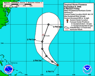
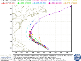
It still appears that Florence will become a hurricane this weekend and the system is on track to take a more northerly turn. That turn will keep Florence away from the U.S. coastline, but the news isn't so good for Bermuda. Florence will pass over or near Bermuda with hurricane force winds late Sunday into Monday.
Closer to home, look for some "fine tuning" for our forecast for next week as a complex weather pattern may setup over the Mid-Atlantic and the Carolinas.
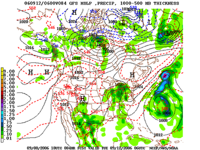 Above is a forecast weather map for Monday night/Tuesday morning from the GFS computer model. Notice the 'H' representing high pressure over the northeast. Winds flow clockwise around a high pressure and that will bring winds from the northeast into North Carolina. To our northeast, of course, we find the Atlantic Ocean and cooler, moist air. That cooler air will push into our state and likely "wedge" against the Appalachian Mountains.
This is a weather pattern meteorologists call "cold air damming", because the mountains act like a dam on a lake damming up the cooler air. Cold air damming, or the "wedge" is a tricky pattern to forecast for in North Carolina. In the winter time, this pattern sometimes puts us on the edge between a cold and damp winter day and a cold and icy winter day. Obviously, this is only September, and it won't be that cold next week. We may see cooler and dreary days next week though. Afternoon temperatures may hang in the 70s. Normal highs are in the low to mid 80s this time of year.
As I mentioned, this is a tricky weather pattern to forecast. We'll keep you up to date with Weather on the Ones updates this weekend on News 14 Carolina only on Time Warner Cable!


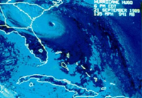


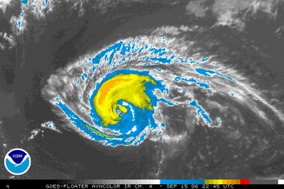
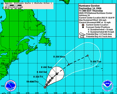


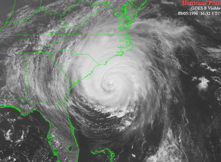
 A big weather story for the first of the week will be Hurricane Florence. As the National Hurricane Center has been forecasting for the last several days, this will not be a big story for the United States, but it will be for Bermuda.
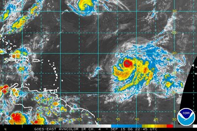
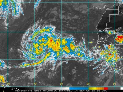
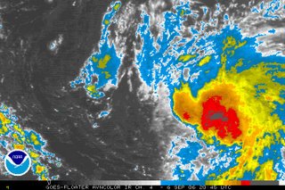
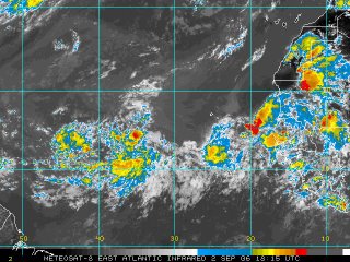
 The National Hurricane Center said Sunday evening the disturbance southeast of Florence could become a tropical depression late Sunday night or Monday. For the latest, be sure to catch our tropical updates at :21 after the hour on News 14 Carolina.

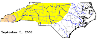 The yellow shading indicates "abnormally dry" conditions. The darker shading represents a "moderate drought." The previous drought monitor had portions of the Triangle under a moderate drought. Tropical Storm Ernesto and other recent rainfalls helped with that. In fact, the Raleigh-Durham Airport is well ahead of normal for the month and year now thanks to heavy rains from late Monday night and Tuesday morning. RDU now has a surplus of over 4" for the year.
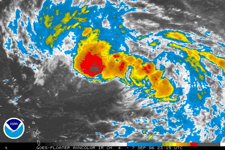


 Tree down near Westover Avenue in Wilson. Photo from Sharon Carr.