
Today's windy weather is created by a couple of factors. An area of low pressure is strengthening off the coast of New Jersey. The tightening of the pressure gradient, or the big change in pressure over a small area, created by that strengthening low makes for a windy day. Combine that with a front moving through North Carolina this afternoon and that and that explains why some spots may see those gusts up to 40mph.
Don't get too used to temperatures in the 70s. The front moving through today will bring cooler air to the state this evening. Lows will drop to the 30s tonight with highs in the 50s for Friday.
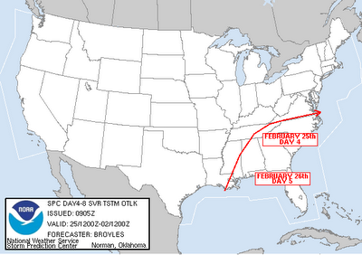
Temperatures will warm some by the second half of the weekend ahead of our next storm system. That will produce rain for central and eastern North Carolina by Sunday afternoon and evening. In fact, the Storm Prediction Center (www.spc.noaa.gov) is watching the region for the possibility for thunderstorms on Sunday --
We'll continue to fine tune the forecast as needed into the weekend. Stay with News 14 Carolina for Weather on the Ones updates every 10 minutes.
No comments:
Post a Comment