
I was just checking out the latest weather data coming into the Weather on the Ones Forecast Center, and it still appears our next best chance to see rain in our area will be on Friday. We cannot rule out an isolated shower or storm Thursday afternoon, but the rain will be more widespread on Friday.
In fact, there will be the possibility for a few strong thunderstorms Friday afternoon and evening. The Storm Prediction Center (SPC) has placed parts of central North Carolina under a "slight risk" for severe weather. The SPC is the government agency that keeps tabs on severe weather across the U.S. When severe weather is possible, the SPC places a specific area under a slight, moderate, or high risk for severe weather. We don't see too many moderate risks issued for North Carolina, and a high risk would be extremely rare. The slight risk means storm experts at the SPC believe there is at least a small possibility for storms to develop Friday that could produce large hail and strong gusty winds.
A lot can change when it comes to weather, so severe weather is not a certainty for Friday. It's just a possibility. Stay tuned to News 14 Carolina and news14.com. We'll keep you updated as the latest weather data comes into the Weather on the Ones forecast center.
If you're already starting to think about those weekend plans, it looks like most of the rain from Friday evening will move out of our region by Saturday. Both Saturday and Sunday look to be calm days with partly cloudy conditions and highs in the low to mid 80s.
On another note, hurricane season for the Atlantic basin begins on Thursday. As you have more than likely heard, this is forecasted to be another active season for the Atlantic basin. You'll find a lot of information about the season in posts listed below this one. I would also encourage you to check back with our blog often, as this will be a great resource for us to pass along the latest information through the season.
Wednesday, May 31, 2006
A Little Rain Causes Big Problems

A few scattered showers and thunderstorms early this Wednesday morning appears to be at least partly to blame for some major rush hour headaches.
Check out the story including video from news14.com -- Thirty-four people injured in I-40 wrecks
Just one example of how we must remain alert on the roads especially when rain may impair our visibility. In this case, the rain more than likely also created a slick highway for motorists. Since, we have not seen too much rain in the past few days, a thin film of oil may have accumulated on the highway surface. Add a little rain to that, and you get a very slick roadway.
Here's some useful information from the NC DOT --
Tuesday, May 30, 2006
Hot Enough for You?
The Memorial Day weekend turned out to be almost perfect in the weather category. The only hickup were the temperatures.
Here's how hot it's been in Raleigh
Friday, May 26: 90
Saturday, May 27: 86
Sunday, May 28 88
Monday, May 29 88
For Fayetteville it wasn't much better
Friday, May 26: 97
Saturday, May 27: 93
Sunday, May 28 90
Monday, May 29 91
We're anticipating a change as we move closer to the weekend. Right now a slow moving cold front is bringing stormy weather to the Upper Midwest and Ohio Valley. This same front will advance our way by Friday increasing our chance for rain and thunderstorms. I think warm and humid conditions will hang around until we can get this front through here. So, hang in there and spend some time by the pool or in the A/C. I think once we get to Saturday and Sunday you will enjoy the results of this passing front.
Saturday, May 27, 2006
Memorial Day Weekend Weather
Memorial Day Weekend sometimes brings stormy weather to North Carolina. In fact on this date (May 27) in 1998, softball size hail was reported near Pekin in Montgomery County! Fortunately, we have not seen anything like that this weekend, but we did get off to a stormy start Friday evening.
Here's a look back at some of the storm reports from Friday's round of severe storms --
Here's a look back at some of the storm reports from Friday's round of severe storms --
- 7:45pm -- Penny size hail reported near the intersection of Wakelon St and Highway 96 in northern Zebulon.
- 8:00pm -- Trees and fences blown down at the Orange County Speedway near Rougemont.
- 8:05pm -- Golfball size hail reported just southwest of Clayton. Also, reported of trees down just outside of Clayton
- 8:10pm -- Tree down reported on Stagwell Road near Bahama in Durham County
- 8:15pm -- Numerous trees down from thunderstorm winds near Creedmoor in southern Granville County.
- 8:25pm -- Trees down and pea size hail reported near Ingleside in Franklin County
- 8:27pm -- Nickel size hail reported near Micro in Johnston County
- 8:59pm -- Wind gust of of 57mph and shingles blown off roof at Buffalo Road and Valley Stream Drive in Raleigh
- 9:00pm -- Nickel size hail reported near Red Springs in Robeson County
- 9:10pm -- Reports of powerlines down about 8 miles east-northeast of Raleigh
We will not have to worry about any more stormy weather for what remains of this holiday weekend. The big story for Sunday and Monday will be the heat. Our forecast calls for highs near 90 both days. With plenty of sunshine expected, you'll want to pack the sunscreen and water bottle for your outdoor plans.
Looking ahead to the work week, there are some indications a few thunderstorms may return by Tuesday afternoon. If these storms develop, they would be isolated in nature. The chance for these isolated storms will remain small for Tuesday. However, our rain chances will increase by Friday of next week.
Enjoy the rest of your holiday weekend. When you need a quick update on the forecast to plan your outdoor activities, we'll be here with your Weather on the Ones only on News 14 Carolina!
Hurricane Awareness Week
On Saturday we take a look at what you need to reflect on when a hurricane or tropical system is headed toward the region.
Taking action is as easy as one...two...three.
Before hurricane season you should assemble your disaster supply kit. These items are often scattered around your home and simply need to be brought together into one location. Also develop your family disaster plan.
Discuss the possible hazards with your family. Determine if you are in an evacuation area and where you would go if you had to evacuate. Identify an out-of-town family contact. When a hurricane watch is issued for the North Carolina coast you should...check your disaster supply kit. Make sure nothing is missing. Determine if there is anything you need to supplement your kit and replenish your water. Then activate your family disaster plan.
Protective measures should be initiated, especially those with coastal property including houses and boats. When a hurricane warning is issued you should...ready your disaster supply kit for use. If you need to evacuate, you should bring your supply kit with you. Use your family disaster plan. Your family should be in the process of completing protective actions and deciding the safest location to be during the storm.
For more information on Hurricane Awareness Week check out this web site.
Hurricane Awareness Week
Friday, May 26, 2006
Friday Severe...

A Severe Thunderstorm Watch is in effect for the entire News 14 Carolina viewing area. Heat, humidity, and a sweeping front will combine to make strong to severe storms Friday afternoon and evening.
Thunderstorms developing this afternoon and evening will do so quickly. Storms will contain the potential for heavy rain, dangerous cloud to ground lightning, strong winds, and small hail.
Keep in mind it doesn't take a large storm to produce a widespread area of damage. The northern Wake county cell from Thursday afternoon was only a few miles wide, but was powerful enough to bring down trees and power lines as it slowly marched across the area. I was in the path of this storm and can report an intense burst of wind which made rains horizontal, reduced visibility to zero, snapping many branches and limbs. Now, the National Weather Service will have the final call on what happened, but as I reported on News 14 Carolina it certainly seemed like a downburst or microburst.
So, as you are beginning the holiday weekend be sure to remain aware of the conditions because they can deteriorate in a hurry ahead storms. Once we get past Friday the holiday weekend will be better weather wise, but still warm. You can rely on News 14 Carolina and Weather on the Ones for up to date information. When the sky turns threatening we'll be on the air for you.
Tuesday, May 23, 2006
Feeding on Numbers
Since all is quiet in North Carolina on this fantastic Tuesday afternoon I decided to look up some numbers that you may or may not be interested in.
50 was the morning low in Raleigh.
57 the low in Fayetteville.
27 in Flagstaff, AZ and Houghton Lake, MI were the lowest temps in the lower 48 on Tuesday.
111, 111, & 101 make Wink, TX a three day champ for the lower 48 in terms of highest temperature.
1 for the number of games the Hurricanes have won in their best of 7 series with the Sabers. Of course the series shifts to Buffalo in a 1-1 tie.
3 to 6 is the number of major hurricanes being forecast by NOAA for the 2006 hurricane season.
22 are the number of wins this season for the Durham Bulls and the Carolina Mudcats before first pitch tonight.
Sunday, May 21, 2006
The Week Ahead...
It's about that time... time to say goodbye to the weekend and look ahead to a new work and school week. We'll start with quiet weather and temperatures a little cooler than we saw on Sunday. Highs on Sunday reached 84 in Raleigh-Durham and 87 in Fayetteville. Monday and Tuesday afternoon temperatures should only reach the mid to upper 70s.
As of this evening, it looks like the big weather story this week could be the warm up coming toward the end of the week. Right now, we are forecasting highs in the upper 80s by Friday. Some of the computer models we use to forecast are suggesting highs could reach the low 90s by the end of the week. That is several days out, and things can certainly change in the world of weather. It does look like we could feel some summer warmth as we get ready for the Memorial Day weekend. In addition to the warmth, a chance for thunderstorms are in the forecast by week's end. We'll keep you posted on with the latest forecast on News 14 Carolina as you start to make your holiday weekend plans.
You'll hear a lot of weather talk in the news this week besides just the Memorial Day forecast. Hurricane Awareness Week starts today across the country. The Atlantic hurricane season begins in just under two weeks, and now is the time to prepare. With recent hurricane seasons that have been devastating, most folks don't need a reminder of what kind of damage a hurricane can do. However, it has been a while since North Carolina has seen extensive hurricane damage first hand. Remember, hurricanes don't only affect coastal areas. They can have a big impact on inland areas bringing flooding rains, damaging winds, and even tornadoes. Gary has posted more information about Hurricane Awareness Week below, and I'm sure we'll have more information on the blog and on News 14 Carolina through the week.
Have a great week!
Rain Chances to Stay South Sunday
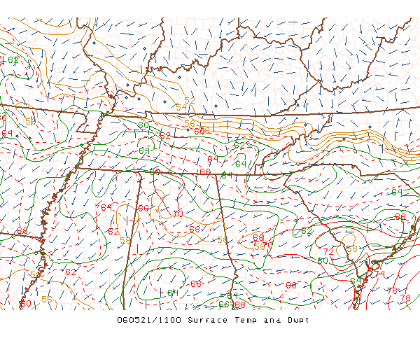 You're looking at the 7am Southeastern U.S. Temperature/Dew Point map from the SPC Hourly Analysis website. If you want to check out this neat site click here. This map is helping out with the forecast for Sunday afternoon. You'll notice the green lines in the Deep South which indicate areas of equal moisture. The further south you look the higher the numbers get and the more moisture is available- which in turn can lead to the development to showers and storms.
In Northwestern and Central North Carolina there is an absence of these green lines. Our air is drier here and that's good news for Sunday. There is a lack of moisture as of this morning which will eventually lead to a dry, but sunny and warm afternoon. I expect storms to develop once again in Tennessee and move southeastward. Today, however, I believe these storms will remain south of the Sandhills and cause problems in Tennessee, Georgia and South Carolina as this same patch of dry air pushes south into the Sandhills through the afternoon.
Now that we've got the weather covered for Sunday I'm left to think about Kentucky Derby winner Barbaro and his possble life threatening injury at the Preakness Stakes. Okay, so I'm an animal lover and it felt like a punch in the stomach to see this horse pull up seriously hurt. **Background story follows*** It was a little more than two weeks ago when I was standing at the rails of Churchill Downs watching many of the Derby contenders warm up on Thursday before the big day. Of all the horses I saw in morning practice Barbaro looked, worked, and acted like a well trained thoroughbred. Two days later he proved his place in Kentucky as a winner and gained a wave of fans and admirers. **Background story end***. It's just upsetting; this wasn't how the Preakness was supposed to unfold.
Okay, I am stepping back from the track talk and will keep my head in the clouds for the rest of the day. I sure hope you have a nice and pleasant Sunday.
Saturday, May 20, 2006
Stormy Saturday Evening
 Hail falling near Fuquay-Varina Saturday evening around 8pm. Photo from Lewis and Courtney Dadisman.
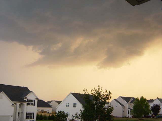 Stormy skies Saturday evening over Fuquay-Varina. Photo from Lewis and Courtney Dadisman.
 Quarter size hail that fell near Brook Street in Clayton Saturday evening. Photo from Patrick Holt.
Most of the day Saturday shaped up to be a nice one. However, we did have a few showers around daybreak and some strong storms toward the evening hours. A few of those strong storms became severe producing some hail across the region. Above, you'll see some of the photos our viewers sent to weather@news14.com. As always, thanks to everyone for sending us your storm reports. In addition to hail reports, one viewer near Holly Springs in Wake County reported a wind gust around 45mph from storms that moved through southern Wake County.
Things should quiet down during the early morning hours on Sunday. We can look forward to a pleasant end to the weekend. Highs should reach the mid 80s during the afternoon.
-Lee Ringer
Improving This Afternoon, Storms by Evening?

The radar was full of life this morning, but only for a broken band of light rain showers moving through the Carolinas. There was some lightning near Charlotte shortly before 4am, but from the Triangle to the Sandhills not a crack of thunder was heard. All of this moisture will continue to move off shore through midday and we'll start to see more sunshine this afternoon.
With 19 days crossed off the May calendar, Raleigh has recorded highs at or above 80 on five days this month (May 4, 5, 6, 11, and 18). Once we get rid of the clouds from this morning we'll make it 6 out of 20. Not that this is unusual considering our average high should be 80 beginning today. Looking down the road we're going to miss the milder temperatures from earlier in the month as a warm up is not too far away. We could be recording highs in the middle to upper 80s late next week as the persistent East Coast trough looks to relax a bit allowing for a late spring warming trend.
Don't forget about the Animal Planet Expo today! I'll use this excerpt as found in my email inbox from earlier this week. I don't think TWC will mind the cut and paste.
Time Warner Cable and News 14 Carolina are proud sponsors of the Animal Planet Expo. You won't want to miss the fun when the folks at Animal Planet join forces with our very own News 14 Carolina talent on Saturday from 10 a.m. to 5 p.m. at Fred G. Bond Metro Park in Cary. Grab the entire family - yes, pets are more than welcome as long as they are on a leash - and head on down to meet News 14 Carolina's Lee Ringer, Vernon Fraley or Gary Stephenson. And that's just the beginning of all the fun you'll have at the Animal House, Bug House and Pet Den - plus much, much more.
LOCATION: The Fred G. Bond Metro Park, 801 High House Road, Cary, NC 27512
DATE: Saturday, May 20th
TIME: 10am – 5pm
ADMISSION: FREE for the entire family
End Excerpt...
I don't know about you, but the Bug House sounds like a good place to take the kids!
Now for the adult readers following the Preakness Stakes today in Baltimore, MD. The weather at Pimlico will be beautiful with highs in the middle to upper 70's by race time. The track should be fast, but winds a bit breezy out of the west from 12-20 mph. Barbaro looks strong, but my money would be sitting with an exacta of 6-5 boxed for the Preakness Stakes. The trifecta is up in the air, but I'll go with 6-5-8. Let's see if the racing forecast is just as good as the afternoon forecast.
Have a Great Weekend!
-Joshua McKinney
Friday, May 19, 2006
Thursday Storm Recap, Drought Update, and a Look Ahead to the Weekend
Finally, the weekend is almost here! The weather should not be too bad for your weekend plans. We certainly could use a couple of nice days after another round of severe weather last night.
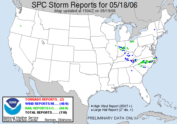
It was another busy day and night in the Weather on the Ones forecast center Thursday as we tried to stay one step ahead of the developing storms. We received several reports of hail and even some wind damage across portions of the News 14 Carolina viewing area. Below, is a map of severe weather reports provided by the Storms Prediction Center for May 18, 2006.
 You'll notice a lot of the severe weather across the U.S. on Thursday was right here in North Carolina. The green dots represent reports of large hail. The blue dots represent wind damage. If you look close enough (you may need to click on the image to open a better view), you'll see one red dot in the state. That indicates a tornado. An eyewitness reported a brief tornado touchdown around 8:45pm near La Grange in Lenoir County.
Here's a look at some selected severe weather reports in and around the News 14 Carolina viewing area --
- 6:15pm -- Golfball size hail reported by the fire department near Highfalls in Moore County.
- 6:20pm -- Nickel size hail reported by law enforcement near Robbins in Moore County
- 6:29pm -- Half inch size hail reported by a trained spotter along Jordan Lake in Chatham County
- 6:45pm -- Penny size hail reported by a trained spotter at the US 15/501 and US 1 split in Lee County
- 6:45pm -- Penny size hail reported by a trained spotter in Cary
- 7:00pm -- Penny size hail reported by law enforcement in Carthage
- 7:02pm -- Pea size hail reported by a trained spotter at the intersection of New Hope Rd. and New Bern Ave. in Raleigh
- 7:05pm -- Reports of trees down just north of Carthage
- 7:10pm -- Nickel size hail reported by law enforcement just west of Angier in Harnett County
- 7:10pm -- Penny size hail reported by a trained spotter in Southern Pines
- 7:20pm -- Penny size hail reported near Vass in Moore County
- 7:30pm -- Penny size hail reported near Spring Lake in northern Cumberland County
- 7:41pm -- 72mph wind gust reported by a trained spotter near Exit #319 on I-40.
- 7:50pm -- Penny size hail reported by law enforcement in Four Oaks in Johnston County
- 8:04pm -- Quarter size hail reported by a trained spotter 10 miles east of Smithfield in Johnston County
- 8:05pm -- Half dollar size hail reported by law enforcement 3 miles southwest of Princeton in Johnston County
- 8:06pm -- Penny size hail reported by law enforcement one mile southeast of Princeton in Johnston County
- 8:06pm -- Penny size hail reported by law enforcement 3 miles southeast of Princeton in Wayne County
- 8:07pm -- Quarter size hail reported by a trained spotter in Princeton in Johnston County
- 8:10pm -- Golf ball size hail reported by law enforcement in Princeton in Johnston County
- 8:11pm -- Penny to nickel size hail reported by law enforcement in downtown Princeton in Johnston County
- 8:12pm -- Penny size hail reported by a trained spotter in the Rosewood area of Wayne County
- 8:25pm -- Dime size hail reported by a trained spotter in Goldsboro
- 8:30pm -- Penny size hail reported by a trained spotter in Pikeville in Wayne County
- 8:40pm -- Law enforcement reported trees down near Mount Olive in Wayne County
So how have recent rains helped with our drought situation across the state? There is some good news on that front. Take a look at the latest drought map released yesterday --
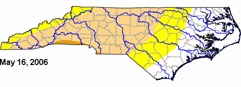 The yellow color represents areas considered to be "abnormally dry." The light brownish color represents a moderate drought, and the sliver of darker brown you see represents a severe drought. If you remember back a few weeks ago, parts of central North Carolina were under a severe drought. That was dropped a couple of weeks ago, and this latest drought update has slightly shrunk the size of the moderate drought. If we could only continue to see a round of rain (without the severe weather!) every several days, we could continue making a dent in the drought. You can read more about the latest drought update by visiting www.ncdrought.org
Let me wrap things up for this post by looking ahead to the weekend. We do stand a chance to pick up some showers and even a few thunderstorms very late Friday night and early Saturday morning. As of early this afternoon, most indications show that most of this rain should move out of region shortly after daybreak Saturday. That will give way to partly cloudy skies by mid-morning and highs reaching near 80 in the afternoon. Of course, we'll keep you posted of any changes to that forecast with Weather on the Ones.
If you're looking for something to do this weekend, Gary has some great ideas in the post below. If your Saturday plans bring you to the Animal Planet Expo tomorrow in Cary, stop by and say hello!
Enjoy your weekend!
-Lee Ringer
Thursday, May 18, 2006
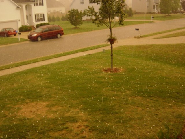
Stormy Thursday Afternoon


Scattered showers and thunderstorms are rumbling across parts of central North Carolina as I write this blog. Some of those storms have been on the strong side with a few reports of hail. We had several reports of hail up to the size of pennies in the Cary area of Wake County. The pictures above were sent to us by a viewer in the Preston area of Cary. Trained spotters also reported hail just smaller than the size of dimes near Jordan Lake in Chatham County.
Most of this thunderstorm activity should diminish later in the evening. We'll keep you posted in the Weather on the Ones forecast center.
If you captured weather photos and would like to share them with us, you can e-mail us at weather@news14.com.
Have a safe evening!
Lee Ringer
Wednesday, May 17, 2006
Wednesday, May 17 Afternoon Update
Allow me to join the rest of the weather team in welcoming you to our new Weather on the Ones blog! If you ever have any ideas on something you would like to see in our blog or just have a weather question, you can always e-mail us at weather@news14.com
Speaking of e-mail, our inboxes were almost overloaded with photos from Sunday's storm. Thanks to everyone who sent in their pictures. We were able to show a few on television, and I've uploaded several more in a blog post you will find below this one. Unfortunately, we were not able to display every picture we received -- just not enough time in the day to get every one uploaded! Thanks again to everyone who sent in their photos, and feel free to e-mail us your photos anytime.
Now, looking ahead to the rest of the week... we do stand the chance to see a few isolated showers or thunderstorms the next couple of afternoons. These will be nothing like Sunday's severe storms. Any showers that develop will be hit or miss. In fact, there may be many neighborhoods that totally miss out on any rainfall.
If you are making weekend plans, Saturday should shape up to be a pleasant day with partly cloudy skies and highs in the upper 70s to low 80s. Sunday could be somewhat of different story. We'll be keeping a close eye on a backdoor front that will try to slip into North Carolina late Sunday into Monday. There is some uncertainty right now as to the timing of this front and exactly how much rain it could bring with it. We'll keep you posted!
More Mother's Day Storm Photos
 Hail near Ten Ten Road. Photo from Tim Babyak
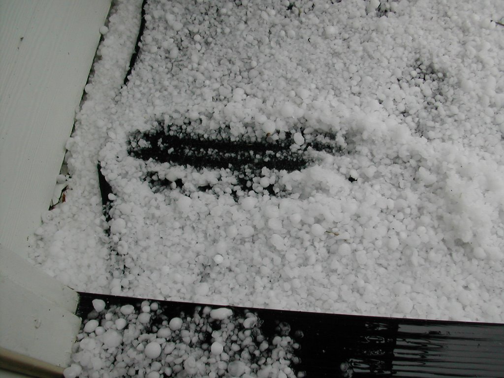 Hail covering the ground in Fuquay-Varina. Photo from Ken Michel.
 Garner hail.
 Hail that fell between Fuquay-Varina and Garner off Lake Wheeler Road.
 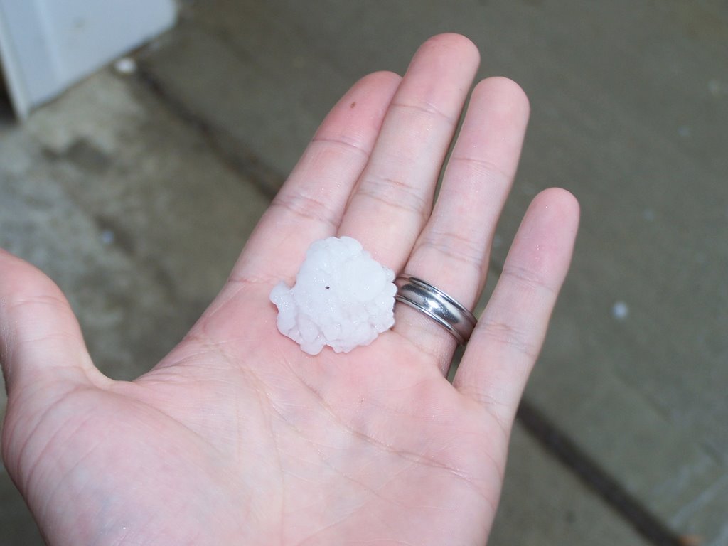 Hail from southeast Raleigh near Alltel Pavilion. Photo taken by Scott Barbee.
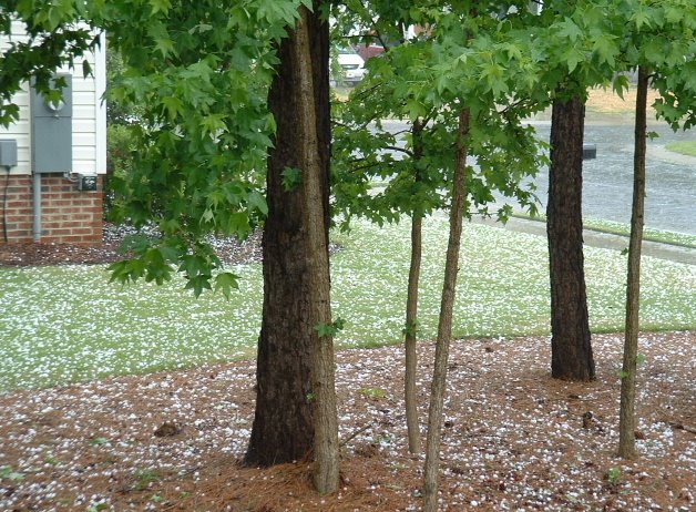 Fuquay-Varina hail photo.
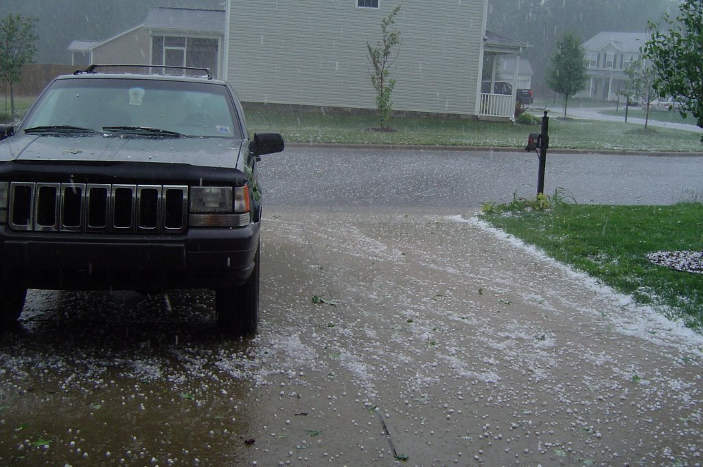 Hail in the Ten Ten Road and Bells Lake Road area. Photo submitted by Renee Yanagawa.
 Hail in Buffalo Road area of Knightdale.
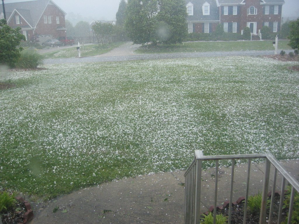 Mothball size hail in the Holly Springs/Fuquay-Varina area of Wake County.
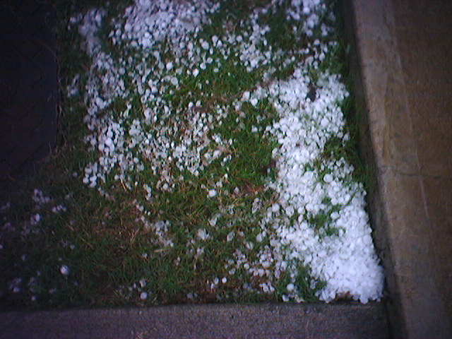 Hail in Hedingham area of northeast Raleigh. Photo taken by Alex Curry.
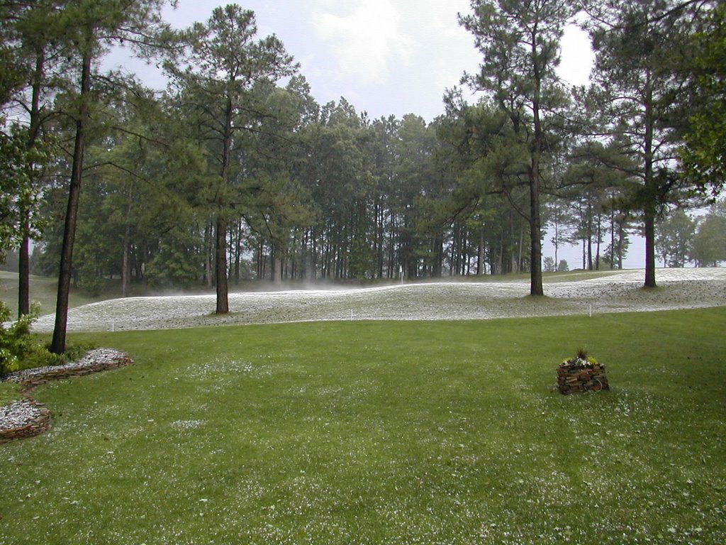 9th green at Crooked Creek Golf Course near Fuquay-Varina. Photo from Ken Michel.
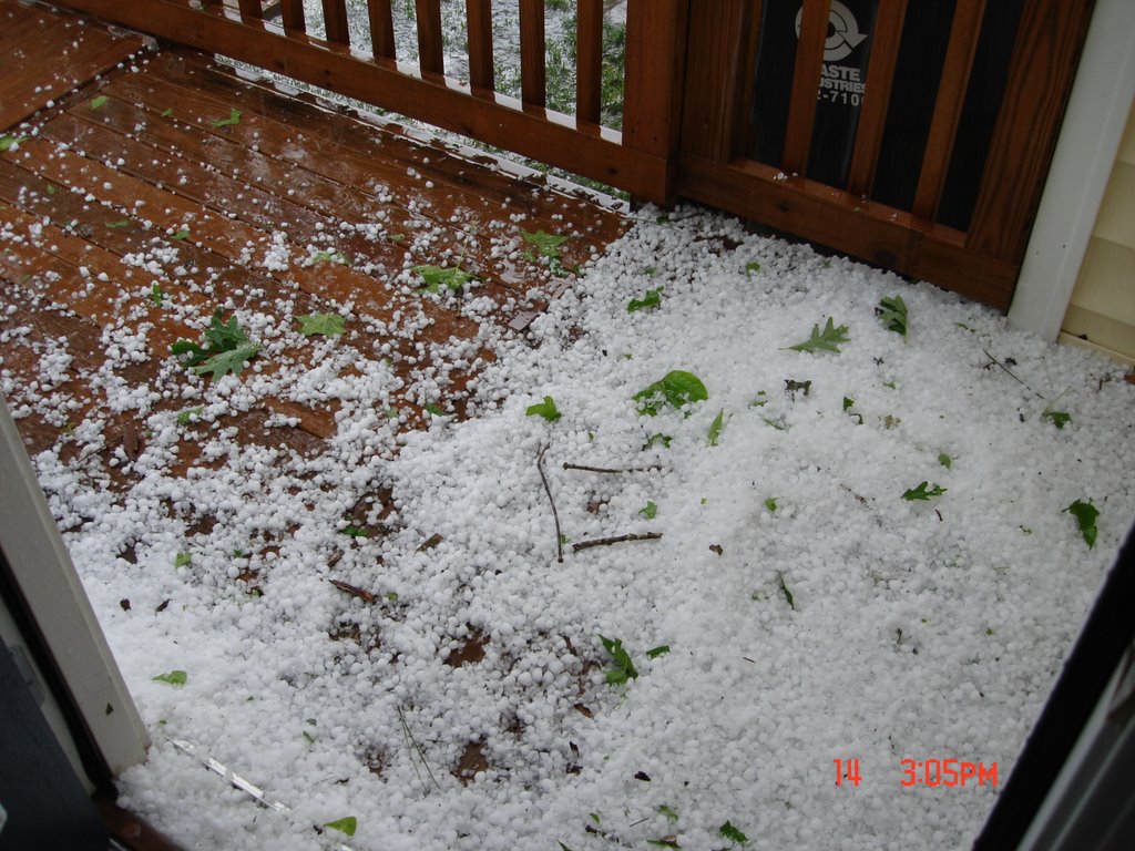 Knightdale hail
 Knightdale hail. Photo from Richard Futrell.
 Hail photo taken off of Rogers Lane near Highway 64 in east Raleigh.
 Hail in east Raleigh. Photo taken by Art.
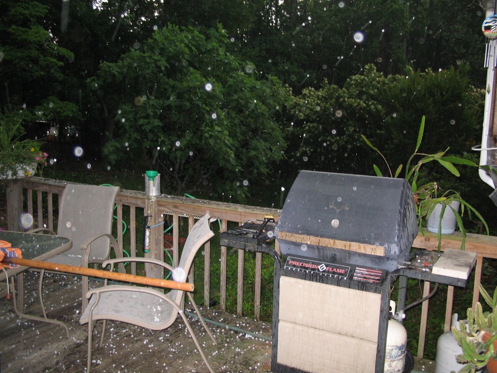 Hail falling in the Heather Hills area of Garner. Photo taken by Phil Egan.
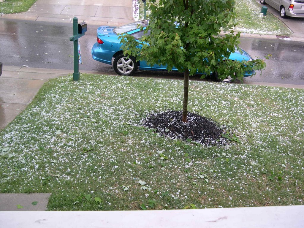 Northeast Raleigh hail. Taken by Jennifer Kelly.
 Hail covers the ground and roads in Fuquay-Varina. Photo submitted by the McLachlan family.
 Quarter size hail from near Fuquay-Varina. Photo taken by Sharon Fraleigh.
 Quarter size hail near Morrisville
  Hail from the Cornwallis Hills area of Hillsborough. Photo taken by Tess and Callie Booker.
  Hail falling near Hedingham golf course in northeast Raleigh.
  Stormy skies over Lake Johnson. Photo taken by Patrick Pyle.
 Quarter sized hail. Photo taken near in Fuquay-Varina by Bob and Pat McGregor
 Dark skies over Hillsborough Street and Glenwood Avenue near downtown Raleigh. Photo submitted by Sam and Jennifer Cederas.
 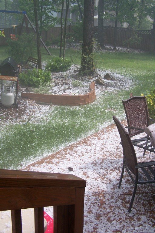 Hail in Orange County submitted by Steve and Renee Sorrell
 Funnel cloud spotted by News 14 Carolina viewer Evan Kasal in Durham.
Hail falling along the Orange/Durham County line. Picture submitted by Darren Strickland.
 The hail near Hillsborough almost looked like snow on this deck.

Hail in Highway 401 area near Garner submitted by News 14 viewer Ray Lewis.
Chilly Start to Wednesday
Talk about a nice refreshing start to the day. Here are some of the morning's lows from around the state. Beginnings like this have always reminded me to appreciate spring time. I don't know about you, but with June and July on the way we certainly won't have too many more cool starts to enjoy.
Raleigh: 47
Fayetteville: 52
Rocky Mt-Wilson: 48
Lumberton: 49
Greensboro: 49
Winston-Salem 46
The forecast is on track for warming temperatures this afternoon with the chance of an isolated shower or a thunderstorm. I believe most spots will range from the upper 70's to low 80's.
Raleigh: 47
Fayetteville: 52
Rocky Mt-Wilson: 48
Lumberton: 49
Greensboro: 49
Winston-Salem 46
The forecast is on track for warming temperatures this afternoon with the chance of an isolated shower or a thunderstorm. I believe most spots will range from the upper 70's to low 80's.
Tuesday, May 16, 2006
Official Storm Survey
Here is the official report on the Lee County tornado which was released on Tuesday afternoon.
PUBLIC INFORMATION STATEMENT
NATIONAL WEATHER SERVICE RALEIGH NC
144 PM EDT TUE MAY 16 2006

...STORM SURVEY TEAM FOUND TORNADO DAMAGE IN LEE COUNTY...

A F1 TORNADO BRIEFLY TOUCHED DOWN 6 MILES EAST OF SANFORD...
OR ABOUT 2 MILES NORTH OF BROADWAY...AT APPROXIMATELY
758 PM EDT MAY 14.  STRUCTURAL DAMAGE WAS MINOR...HOWEVER
THERE WAS SIGNIFICANT TREE DAMAGE FROM UPROOTED AND SNAPPED
TREES BEGINNING NEAR THE INTERSECTION OF SALEM CHURCH ROAD
AND DALRYMPLE FARM ROAD...CONTINUING FOR APPROXIMATELY ONE
HALF MILE EAST THROUGH A HEAVILY WOODED AREA JUST SOUTHWEST
OF COPELAND ROAD.  WINDS WERE ESTIMATED AT 100 MPH WITH PATH
DAMAGE ONE HALF MILE LONG AND 100 YARDS WIDE.

INITIAL DAMAGE BEGAN AT APPROXIMATELY 750 PM EDT IN THE CITY
LIMITS OF SANFORD WHERE STRAIGHT LINE WINDS CAUSED MINOR ROOF
DAMAGE TO AN OLD WAREHOUSE AT THE INTERSECTION OF THIRD AND
COURTLAND DRIVE. SHORTLY THEREAFTER...COUNTY HIGHWAY PATROLMEN
SPOTTED A FUNNEL CLOUD MOVING EAST NORTHEAST ALONG HIGHWAY 42.
RESIDENTS ALONG HIGHWAY 42 AND AVENTS FERRY CONFIRMED THE
FUNNEL CLOUD REPORT...NOTING A DISTINCT HOWLING SOUND AND VERY
STRONG WINDS.  THE STRONG STRAIGHT LINE WINDS WERE ESTIMATED
AT 60 TO 75 MPH...SNAPPING SMALL TREES ON ADJACENT NEARBY
PROPERTY.

AT 758 PM EDT...NEAR THE INTERSECTION OF SALEM CHURCH ROAD
AND DALRYMPLE FARM ROAD...SIGNIFICANT DAMAGE BEGAN WITH
NUMEROUS LARGE TREES SNAPPED...MINOR DAMAGE TO A HOME...AND
A BARN DESTROYED. THE DAMAGE CONTINUED EAST NORTHEAST THROUGH
A HEAVILY WOODED FOREST FOR APPROXIMATELY ONE HALF MILE.

IT IS BELIEVED THAT DURING THIS ONE HALF MILE PATH...THE
TORNADO  MADE SEVERAL BRIEF TOUCHDOWNS...WHERE THERE WERE
OBVIOUS SIGNS OF DESTRUCTION WITH DOWNED TREES RESTED IN
VARIOUS DIRECTIONS. THE DAMAGE CLIMAXED IN THE WOODED FOREST
WHERE WINDS WHERE ESTIMATED AT 100 MPH.
Tuesday Afternoon Update
Stormtrack Doppler Radar is set on a wide view this afternoon while we get a break from showers and storms in Central and Eastern North Carolina. You have to look all the way back to Alabama, Tennessee, and Kentucky before you run in to any rain and thunder.
The same spinning low that we've been talking about at length since late last week is finally showing signs of slowly pulling out, but not before it sends another round of afternoon showers and storms in our direction for Wednesday.
So why have we been seeing clouds and storms the past few days? This same low is mainly just a pocket of colder air in the mid and upper atmosphere. When air at ground level is warmed, namely by sunshine, it rises. This warmer air is going to keep rising through the cooler pocket while forming clouds and eventually producing rain and thunderstorms. Once we lose daytime heating, the clouds go away and our skies clear out just in time to do it all over again the next day.
So, the chance for showers and a few storms will hang around at least through Friday as the slow low continues to move away.
As for temperatures, we've been a bit below average the past couple days. Today we reached 72 in both Raleigh and Fayetteville. For the rest of the week we'll stay right around the average of 79 for Raleigh in mid May. Expect us to be pushing the upper 70's to low 80's by Friday.
Right now a front is likely to push through Friday ending the rain late thus making the weekend pleasant, but any timing issues will need to be addressed. Some computer models want to slow this front and keep it close to the Carolinas.
Next Week: We could be in for a big warm up down the road as the jet stream is looking to make a push to the north. If this is the case then we'll be seeing the thermometer easily in the mid to upper 80's by May 25th.
Update: The National Weather Service has confirmed a tornado from the Mother's Day Event in North Carolina. An F1 tornado touched down 2 miles north of Broadway in Lee County and remained on the ground for at least a half mile. Winds were estimated to be 100 miles per hour! You can read about the update here in this report.
Mother's Day Recap

As expected, Mother's Day was stormy across the Carolinas. Clusters of storms dumped heavy rain and golf ball size hail during the afternoon on Sunday. Damaging winds along with a couple of tornadoes were reported to have touched down in Wake and Lee Counties. The Forecast Center was buzzing with activity as Gary Stephenson, Lee Ringer, and I were covering every angle to stay ahead of the advancing storms.
At home you were no doubt watching us use Stormtracker Doppler Radar to monitor the movement of each storm, but off camera there was a lot going on. New warnings were being issued every few minutes during the height of the activity, along with damage reports confirming the severity of these storms. It is our commitment to pass this information to you as accurately and as quickly as possible. That's the benefit of going wall to wall on News 14 Carolina for severe weather coverage; we can uphold that commitment to you.
Our friends at the National Weather Service in Raleigh have compiled some information about the entire event. You can view the details of this preliminary report by clicking here. (May 14, Event Summary)
Many Weather on the Ones watchers sent in their personal photos and video via email. This information was key to helping us verify the same storms we were following on radar. Our inbox was flooded with more than 85 emails containing pictures. In fact, the above picture was sent by Julia Faturova from Wake County. We certainly appreciate all the help from you at home. If you ever have a photo you'd like to send you can reach us at weather@news14.com, but keep in mind our mission is your safety. Never put yourself in a dangerous situation.
So, I bid you welcome to the Weather on the Ones Blog. I'm looking forward to reaching out to you in a new, more hip way. I'll update as often as I can and bring you some of the weather stories not mentioned on the air.
Meteorologist Joshua McKinney
Monday, May 15, 2006
Welcome!

Welcome to the Weather on the Ones blog from News 14 Carolina's team of meteorologists. Have a question about the weather? Email your question to weather@news14.com.
Subscribe to:
Posts (Atom)