
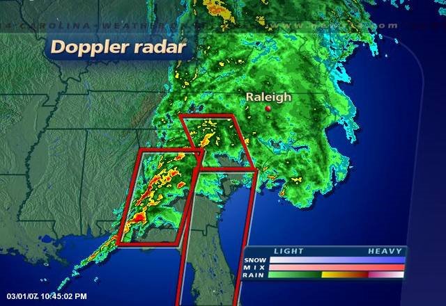
The back edge of the main line of thunderstorms is pressing eastward through West Georgia. There are still three tornado watches in effect and storms can be found within each watch. A little closer to the Triangle temperatures are in the upper 50's to lower 60's as a steady rain falls. Warmer air continues press in ahead of a cold front which would indicate the possibility for storms still exists past midnight tonight. Lightning though is showing signs of weakening throughout the entire line of storms. This could be encouraging, but it could also be lull in the action before it ramps up again.
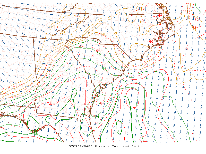
I'm still relying on the temperature/dew point map from the hourly analysis page at the SPC. It's continuing to show rich moisture is having a hard time making it into Central North Carolina. Right now, deep moisture is confined mainly in South Carolina and points southward. There is still a shot we could see dew points climb briefly before the front crashes in, but right now it isn't happening.
No comments:
Post a Comment