Hail photos from Rolesville on Sunday evening. Photos submitted by News 14 Carolina viewer Tabitha Daniels.
You can send your weather photos to us by e-mailing weather@news14.com.
Hail near Youngsville Sunday afternoon. Photo from News 14 Carolina viewer Suzanne Gardner.
Viewer photo of a tree down along Mal Weathers Road near Garner. Photo from News 14 Carolina viewer Cameron Feaster.
Above two photos of storm clouds over Wake County from News 14 Carolina viewer Michelle Pepper.

If strong storms develop, damaging winds will be the biggest threat. Heavy rains may be a threat for some spots as well. While we could use a good soaking rain, heavy rain falling too fast may produce some flooding issues. The National Weather Service has posted a Flood Watch through 6am for the central part of the state. Two to three inches of rain is possible in the watch area. Elsewhere, one to inches of rain is possible.
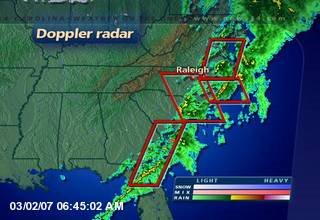
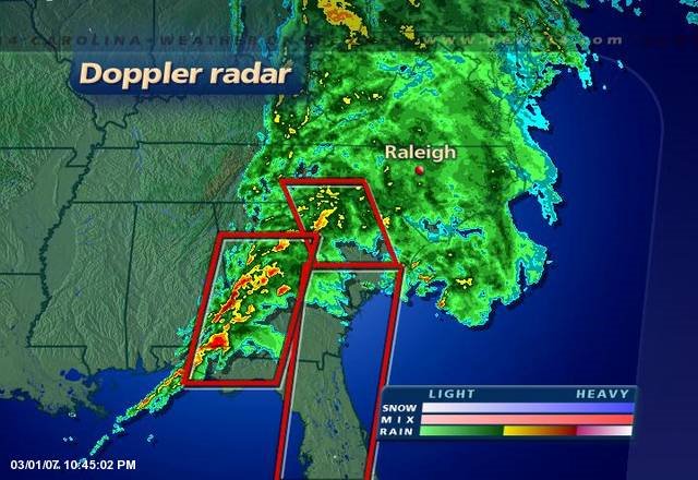
Quiet weather is still holding on during the early evening hours here in central North Carolina, but it appears that will change late tonight. As I post this blog entry, strong to severe storms are rumbling across Alabama and Georgia. This storm system will move into the Carolinas over the next few hours.
The same storm system that produced severe weather over the south-central United States on Friday is now marching across the southeast. The above image from the Storm Prediction Center shows the severe weather reports received Friday. The green dots represent reports of large hail, the blue dots represent wind damage reports, and the red dots indicate tornado reports.
While the greatest threat for severe storms will remain to our south, we cannot not rule out a few strong to severe storms overnight. Some of the strongest storms in our area could occur while most people are asleep. Make sure your weather radio is on standby mode tonight just in case severe weather develops. Also, stay tuned to News 14 Carolina. We'll have Weather on the Ones updates through the night. You can also find updated radar views on news14.com and we'll have occasional updates here on on Weather on the Ones blog. 
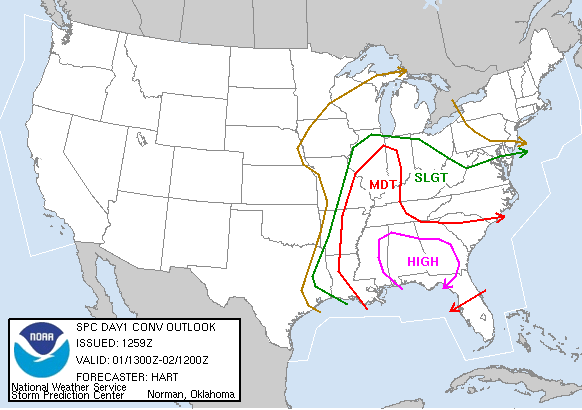
On Saturday that "moderate risk" of severe weather shifts to parts of the Southeast --

Tornadoes, hail, and damaging thunderstorm winds are possible within the moderate risk areas both Friday and Saturday.
The storm system will then move toward the Carolinas bringing us rain late Saturday night into early Sunday morning. While the risk for severe weather is not nearly as high for us, a few strong storms cannot be ruled out. We'll follow the storm through the weekend and have the latest with Weather on the Ones updates on News 14 Carolina. When you are away from your TV this weekend, you can find updates here on our weather blog and on our website at news14.com.
For Greensboro --
Wednesday afternoon also brought a round of severe thunderstorms north of the Triangle. In the News 14 Carolina viewing area, Granville County was the hardest hit. Flash flooding and hail up to the size of quarters was reported in Oxford. Elsewhere, near baseball sized hail was reported in Rocky Mount. If you have photos of Wednesday's severe weather, you can share them with us by e-mailing weather@news14.com.
Check out some of the pictures we have received in the blog post below.


As a "back door" cold front moves into the state this afternoon, we expect scattered showers and storms to develop. The greatest threat from the strongest storms will be large hail. We're closely watching StormTracker Doppler radar and will have Weather on the Ones updates every 10 minutes through the afternoon and evening. If severe weather occurs in your neighborhood, you can send storm reports and pictures to the Weather on the Ones Forecast Center by e-mailing weather@news14.com.

A lot has changed in weather forecasting in the last twenty-three years. We now have a network of Doppler radars that can provide advanced warnings of developing severe thunderstorms and tornadoes. Thanks to efforts by the National Weather Service and media outlets, the public is better informed on what to do in the event of a tornado. If something like the Carolina's Outbreak of 1984 were to happen again, hopefully the number of fatalities and injuries would be much less.
While widespread severe outbreaks like this one in 1984 are rare in the Carolinas, it serves as a reminder that strong tornadoes can occur here. Do you know where you and your family would go for safety if a tornado were headed for your home or business?
You can read more about the March 28, 1984 Carolinas Outbreak through the following links --
The North Carolina drought monitor released this week now shows much of the state has "abnormally dry" conditions. This is represented by the yellow shading on the above map. The darker shading in western North Carolina represents a "moderate drought" in the mountains.

Temperatures should reach near Wednesday's highs Thursday, but this is the last of a string of warm days at least for a little while. We are watching a cold front to our north and a low pressure system along the Gulf coast that will bring our changing weather over the next 24 hours.

We should begin to see a few rain showers Thursday evening, but look for the rain to pick up overnight into Friday morning as that cold front and low pressure move across North Carolina.

We are likely to see beneficial rain from this storm system. According to rainfall data for the Raleigh-Durham Airport, the Triangle is more than 3 inches behind in rain for the year. Most computer models suggest we could have anywhere between one and two inches of rain late Thursday night and Friday.

Temperatures will drop through the day Friday. We'll more than likely have our highs in the low 60s early Friday morning. Temperatures will drop to the upper 40s by Friday afternoon as the rain comes to an end. Lows should then drop to the low 30s for Saturday morning.
The weekend forecast will remain dry, but it will be chilly for Saint Patrick's Day. Highs on Saturday may only top out near 50.
School kids all across North Carolina today practiced what they would do if their school was in the path of a tornado. Today's statewide tornado drill took place around 9:15am and was all part of Severe Weather Awareness Week. While our kids now know what to do during a Tornado Warning at school, do you what to do if a Tornado Warning is issued and you were at home?
Above is the scene around Washington, DC. That image was taken around midday Wednesday from a National Park Service webcam. Our nation's capital has reported snow showers at times today with temperatures in the 30s. Farther to the north, temperatures are in the 20s all day in New York City. I think I'll take the 60s here in North Carolina over highs in the 20s or 30s anyday!
For more information, click to --