
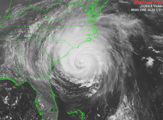
Ten years ago, North Carolina residents from the coast to the Triangle were beginning the clean up process after Hurricane Fran. That hurricane is just one example of how tropical systems don't only affect the coast. Over 1.7 million homes in North Carolina lost electricity in the storm. Wake County alone reported $900 million in damage to residential and commerical property.
The National Weather Service in Raleigh has an excellent website looking back at Fran and how it impacted central North Carolina. Check it out by clicking to http://www4.ncsu.edu/~nwsfo/storage/cases/19960906/
Ten years after Fran, we are tracking another storm that begins with the letter "F." This one is called Florence
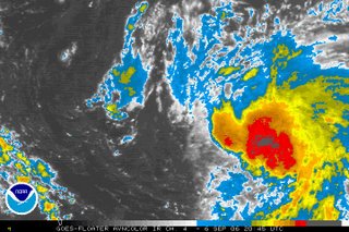
North Carolina doesn't have a good history when it comes to tropical systems with a name that begins with F. Fran is just one example. Floyd is another. Right now, it appears that Florence will not go down in history as one of these bad "F" storms for North Carolina. Most computer models are in agreement that Florence will take a turn later this weekend keeping it out to sea.
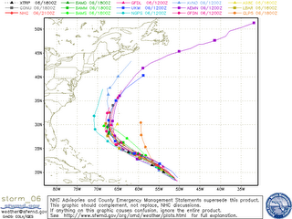
Keep in mind, tropical storms and hurricanes don't always follow the path forecasted. We'll have to watch this one closely until it makes the forecasted turn.
While that turn may be good for the Carolina coast, it may not be so good for Bermuda. Take a look at the official forecast track from the National Hurricane Center as of the 5pm Wednesday advisory --
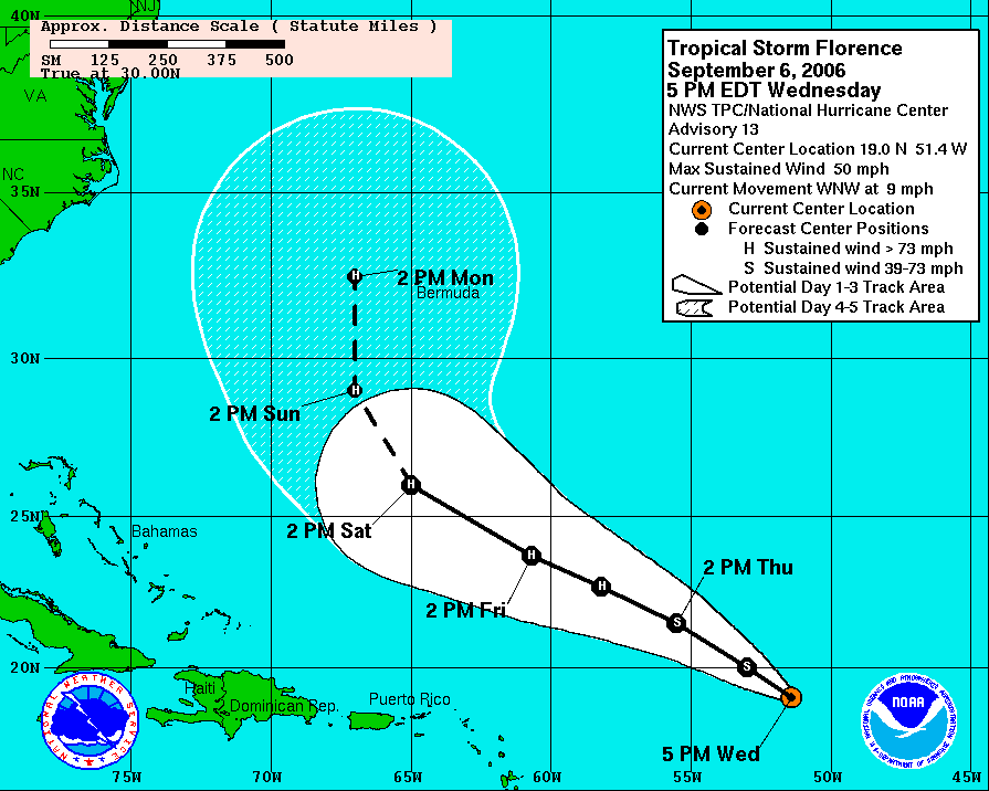 The NHC is forecasting Florence to become a hurricane during the day Thursday and to become a category 3 hurricane late in the weekend. We'll keep you posted with tropical updates at :21 after the hour every hour on News 14 Carolina. You can also find the latest forecasts from the National Hurricane Center at www.nhc.noaa.gov
No comments:
Post a Comment