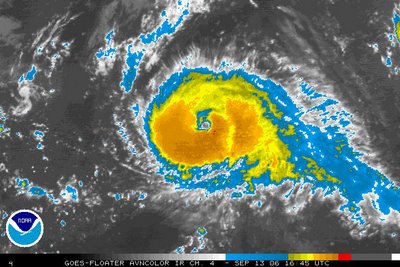
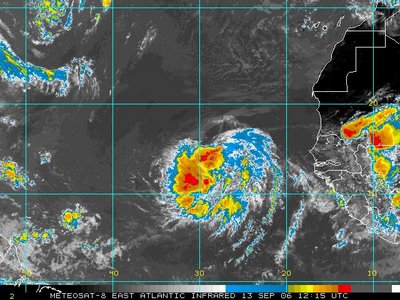
With Florence becoming extratropical, there are still two systems to watch.
 Hurricane Gordon has gained strength this Wednesday and could become a category 2 hurricane within the next 24 hours. Gordon is moving to the north and should pass well to the east of Bermuda. This would keep Gordon away from any land areas. Gordon will not pose any threat to the U.S.
The other system we are watching is Tropical Depression #8....
 This one is a long ways away from the United States. In fact, it is just to the west of the African coast. Tropical Depression #8 is moving west and could become a tropical storm within the next day or two. At that point, it would be given the name "Helene" Eventually, the storm would take a more northwesterly path late in the week or weekend when it could become a hurricane. It is too early to say whether or not this would ever threaten the U.S., so stay tuned...
Stay informed on the tropics with our tropical updates at :21 past the hour on News 14 Carolina.
Closer to home, it is a dreary Wednesday in central North Carolina. With cloudy skies and rain moving into the area at midday, temperatures are holding steady in the mid to upper 60s. We don't expect temperatures to get any warmer through the afternoon. In fact, temperatures should hold fairly steady in the 60s overnight and into Thursday morning.
If you don't like the dreary weather, brighter conditions will be on tap for the weekend. Something to look forward to!

No comments:
Post a Comment