
We have another chance to break a record today. Thursday's records stand at 76 set in 1998 for Raleigh-Durham and 74 set in 1991 for Greensboro. As of midday, we are very close to those records.
This unusually warm weather can't last forever. It is almost December, after all! Changing weather is on the horizon. Take a look at the cold air across the western United States --
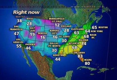
Temperatures from midday Thursday.
Along the leading edge of that cold air we have quite a storm system marching across the United States. Some strong storms are possible this afternoon in parts of the southeast, and snow is falling from Texas to Oklahoma to Missouri.
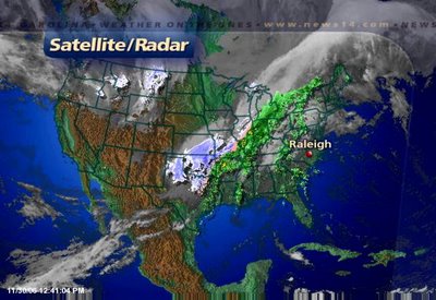
Satellite/radar composite from midday Thursday.
This storm will not bring wintry weather to North Carolina, but it will bring rain for Friday with the chance for a few thunderstorms. If thunderstorms develop along the cold front, a few could produce gusty winds. Because of the small threat for damaging winds, the Storms Prediction Center has placed parts of North Carolina under a "slight risk" for severe weather.
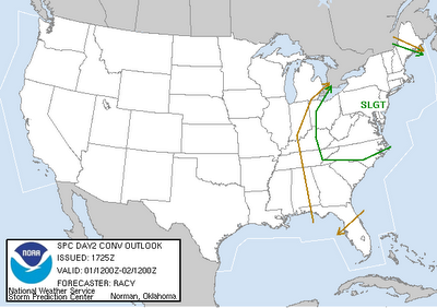
Severe weather outlook for Friday.
We'll keep you posted through the day on Friday in the event any strong storms do form. Count on News 14 Carolina for the very latest weather information every 10 minutes with Weather on the Ones.
The cooler air arrives this weekend. While the coldest air won't makes its way into the Carolinas, we will notice a difference in the temperatures. Highs will only reach the 50s on Saturday and Sunday with morning lows in the 30s.
No comments:
Post a Comment