
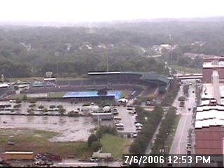
That picture of the Durham Bulls Athletic Park should look much better for Friday and the weekend!
Today's showers and thunderstorms are the result of a cold front passing through the state. As the front passes to the south and southeast, the rain should come to an end through the late afternoon and evening. Behind the cold front, slightly cooler and drier air will filter into the state. That means the heat and humidity from early this week will take a break, for at least a few days. Friday's highs are forecasted to reach the mid 80s, but with the lower humidity it will feel very comfortable.
The lower heat and humidity won't last forever though. It is July after all! Computer models are suggesting a return to typical summer weather conditions in North Carolina, and I don't see any reason why that forecast will not hold. Highs will climb back to the low to mid 90s next week with that chance for a few pop-up storms in the afternoons. So, enjoy the comfortable weather while it lasts!
No comments:
Post a Comment