
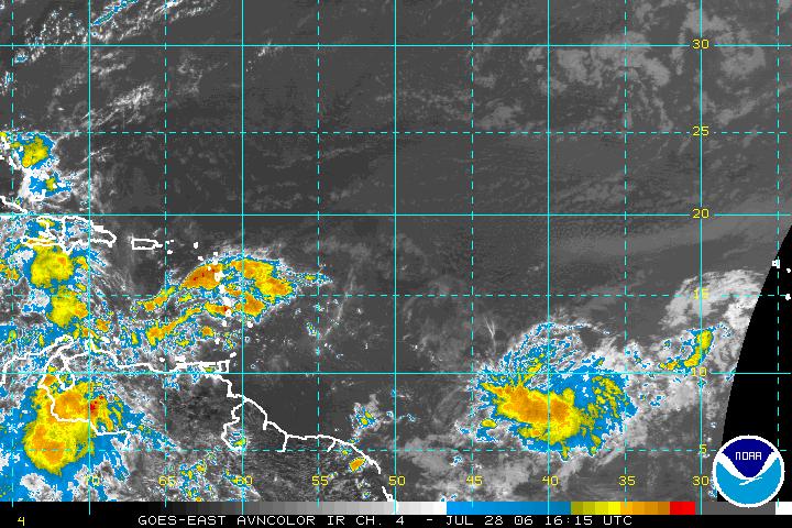
We are watching two tropical waves in the Atlantic basin as we head into the weekend. The satellite image above captured both of these waves from early Friday afternoon. The first wave on the left side of that satellite picture is making its way through the Caribbean. At this time, conditions are not favorable in the upper atmosphere for this tropical wave to develop into a tropical storm. There is just too much wind shear for this to develop.
That may be a different story for the other tropical wave we are watching. This one toward bottom right of the satellite image was located about 1000 miles west-southwest of the Cape Verde Islands. The disturbance appears to be fairly healthy today. Conditions in this area of the Atlantic may be favorable for slow development over the weekend. This one has the potential to become our next tropical depression within the next couple of days as it moves to the west or to the west-northwest. If it does develop into a tropical cyclone, it is a long ways from land, so there will be plenty of time to watch it. We'll keep you posted in our tropical updates at :21 past the hour on News 14 Carolina.
No comments:
Post a Comment