
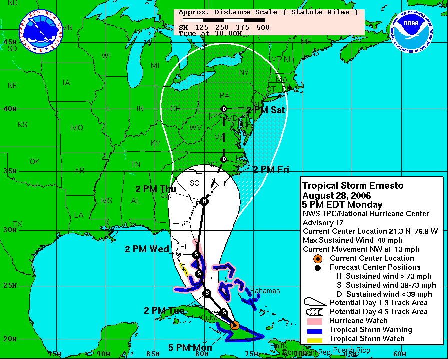
 And here's a look at the different computer model forecasts for the storm's path as of Monday evening --
A lot of the models bring the storm, or what may remain of the storm toward North Carolina toward the end of the work week. We could use some rain across the state, but we may be setting up for too much rain in some areas. A cold front will approach North Carolina over the next couple of days and may stall out over our region. These stalled out fronts often act as the focus for heavy, and even flooding rains from tropical systems. You will probably recall the flooding in Raleigh earlier this summer when the remnants of Alberto moved through the state. A stalled out front was present then and focused the heaviest rains over the Triangle, especially over the city of Raleigh.
It is much to early to say if all of the weather variables will come together to produce flooding rains later this week, but we will have to monitor the weather situation very closely. Stay tuned to Weather on the Ones. We'll have the very latest on Ernesto every 10 minutes.
You can also find more information online from these links --
No comments:
Post a Comment