
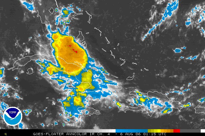
Tropical Depression Chris dissipated over Cuba Saturday morning. You can see from the above satellite image taken Saturday evening that there has been a flare up in thunderstorms from what remains of Chris over Cuba and just north of Cuba. We'll have to watch the remnants of Chris and it drifts toward the Gulf of Mexico.
Elsewhere in the tropics, we'll also be watching a tropical wave moving off the coast of Africa...
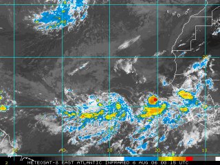
As that wave moves to the west, there may be some room for slow tropical development into early next week. For the latest on the tropics online, visit the National Hurricane Center's website at www.nhc.noaa.gov or tune in to our tropical updates at:21 after the hour on News 14 Carolina.
In North Carolina weather news, we did have some relief from the heat this Saturday. It wasn't a lot as we still hit a high of 89 at RDU, but that sure does beat the upper 90s and heat index values near 110 that we experienced the last several days! Our forecast does include a slight warm up to the low to mid 90s early next week. Normal early August highs are in the upper 80s to near 90.
No comments:
Post a Comment