
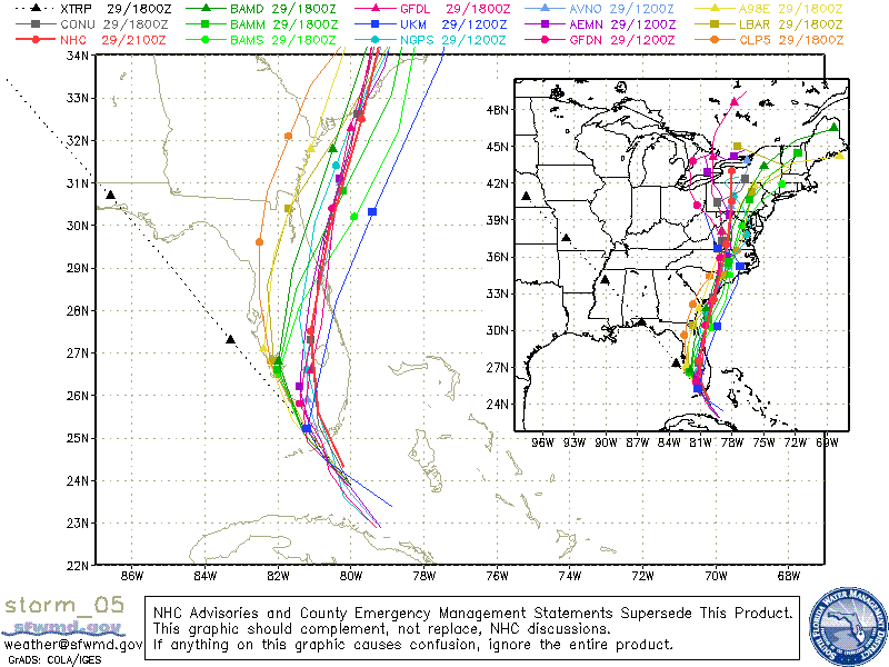
Many computer models are still in agreement that Ernesto or what may remain of Ernesto will track over central or eastern North Carolina late Thursday or Friday...
 and forecasters at the National Hurricane Center agree...
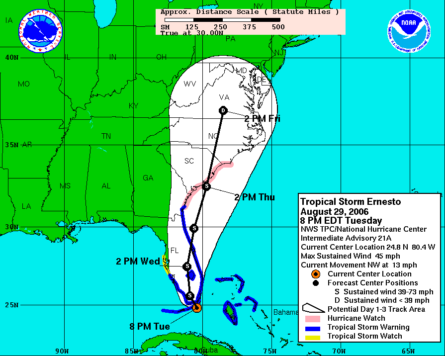
Ernesto is not a very strong tropical storm. As of the 8pm advisory Tuesday, the storm had sustained winds estimated at 45mph. With the storm about to move into south Florida, we would not expect any significant strengthening. The storm will likely weaken while it's over Florida during the day Wednesday. It may then move back over the Atlantic where it would have a small window to strengthen if it follows the NHC path back inland somewhere near Charleston, SC. Keep in mind the there is still room for error in the forecast track.
It does not appear that Ernesto will be a powerful storm when it comes to winds, but Ernesto poses another danger -- flooding rains. We continue to look at the possibility for a weather set up that would lead to very heavy rainfall over North Carolina Thursday into the day on Friday. A front that will move into the state Wednesday could stall out over the region. As I mentioned yesterday, these stalled out fronts tend to squeeze out very heavy rains from even weakened tropical systems. This may be the case as Ernesto moves in.
Wednesday afternoon and evening will bring some scattered showers and storms to the region, but these will be the result of the front and not Ernesto. Expect the rain to pick up during the day Thursday and continue through at least early Friday. The exact point where this front may stall out and the exact track of Ernesto will determine the locations that pick up the most rain. Three to six inches is possible with higher amounts certainly possible. Even though we are somewhat dry in central North Carolina, too much rain at once could easily lead to flooding. This is all not set in stone just yet. We'll continue to monitor Ernesto and fine tune our forecast as it approaches.
Stay tuned to News 14 Carolina, your only source for Ernesto updates every 10 minutes with Weather on the Ones.
No comments:
Post a Comment