
 The above satellite image from Tuesday evening does not look too much different than the satellite image from last night. In other words, there hasn't been much organization of this system yet. However, there is still some room for this to potentially develop into a tropical depression over the coming days as it drifts a little closer to the Carolina coast. There is still some question on whether or not this will actually develop into a tropical cyclone. Of course, we'll keep you posted.
There is another system that appears better organized on satellite this evening. That disturbance is in the Gulf of Mexico --
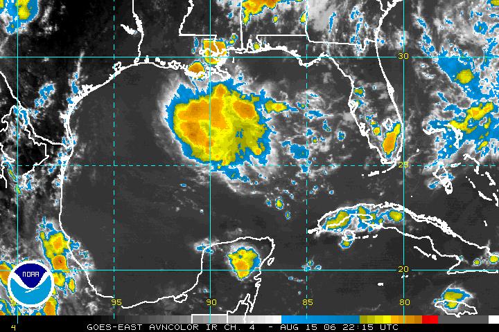 Showers and storms associated with a trough of low pressure really blew up in the north central Gulf today. Sometimes a blow of thunderstorms like this will diminish with the loss of daytime heating. Other times, the storms hang on overnight, and if that happens, this system has the potential to become a tropical cyclone. As of now, this system is nearly stationary. However, anytime something develops in this part of the Gulf it almost has to move toward land since land surrounds it on pretty much all sides.
And much, much farther out in the Atlantic, here's a look at what's happening --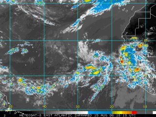
A tropical wave moved off the coast of Africa yesterday but diminished some today. Another cluster of storms appears to be moving toward the coast this evening. This area near the Cape Verde Islands off the African coast typically becomes active toward late August and early September, so this is just another region that needs to be watched.
For the very latest on the tropics, tune in for our tropical updates at :21 after the hour every hour. You can also find more information online at www.nhc.noaa.gov
No comments:
Post a Comment