
We may set another record or at least tie it Friday afternoon. The record high for August 4 at RDU stands at 96 set in 1980. Highs will likely reach the mid to upper 90s with heat index values as high as 105. With the heat of the day, scattered showers and storms could develop by the late afternoon and evening hours. These showers and storms may be a little more numerous than the few isolated storms we saw Thursday afternoon and evening. We'll keep a close eye on Stormtracker Doppler radar Friday afternoon as storms may become strong with heavy downpours, frequent lightning, and gusty winds.
A slight cool down is on the way for the weekend. Of course, this "cool down" is all relative. It is early August after all! Highs in the upper 80s are expected Saturday and Sunday. That is near normal levels for this time of year, but it sure does beat the upper 90s! If you are thinking about outdoor plans this weekend, keep an eye to the sky as thunderstorms will be a possibility both Saturday and Sunday afternoons.
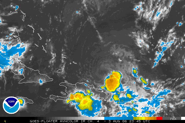
Now from the heat to the tropics... Take a look at the satellite image of Tropical Storm Chris from Thursday evening --
and compare it to this satellite image from Wednesday evening --
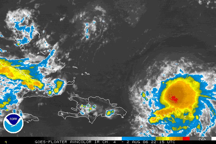
Chris weakened Thursday morning as it entrained drier air into the storm. It is barely hanging on as a tropical storm as I write this blog. However, the latest satellite imagery shows storms may be again building around the center of circulation. As of the 8pm advisory, the National Hurricane Center is still forecasting Chris to weaken to a tropical depression within the next 12 to 24 hours. As with any tropical system, there is some uncertainty to exactly what Chris will do. For the very latest information, you can visit the National Hurricane Center's webpage at http://www.nhc.noaa.gov or tune in for our tropical update at :21 after the hour on News 14 Carolina.
No comments:
Post a Comment