
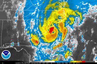
It's been a busy day and night in the Weather on the Ones Forecast Center, so I will keep this brief. As I write this blog post, Ernesto is not far from making landfall along the southeastern coast of North Carolina. The heaviest rain amounts through the overnight and early morning can be expected just along and to the east of the storm's path. It appears the swath of heavy rain will set up to the east of the Triangle. In the News 14 Carolina viewing area, the highest rain amounts can be expected along I-95 and to the east. The Triangle still stands the chance to pick up a decent amount of rain, and we must all still very cautious as flooding cannot be ruled out early Friday morning. A Flash Flood Watch is in effect through Friday morning.
For the very latest on Ernesto, tune to News 14 Carolina on Time Warner Cable. Our team will staff the weather center through the overnight and early morning hours to provide you Ernesto updates every 10 minutes.
And, if you were wondering if there is anything else developing in the tropics.... take a look at the satellite image Thursday night off the African coast.
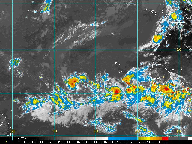 There are no organized systems there right now, but we'll have to watch those tropical waves as they move across the Atlantic. Stay tuned...
No comments:
Post a Comment